| SURAU KHAEK |

| Text & maps by Tricky Vandenberg - April 2016 |
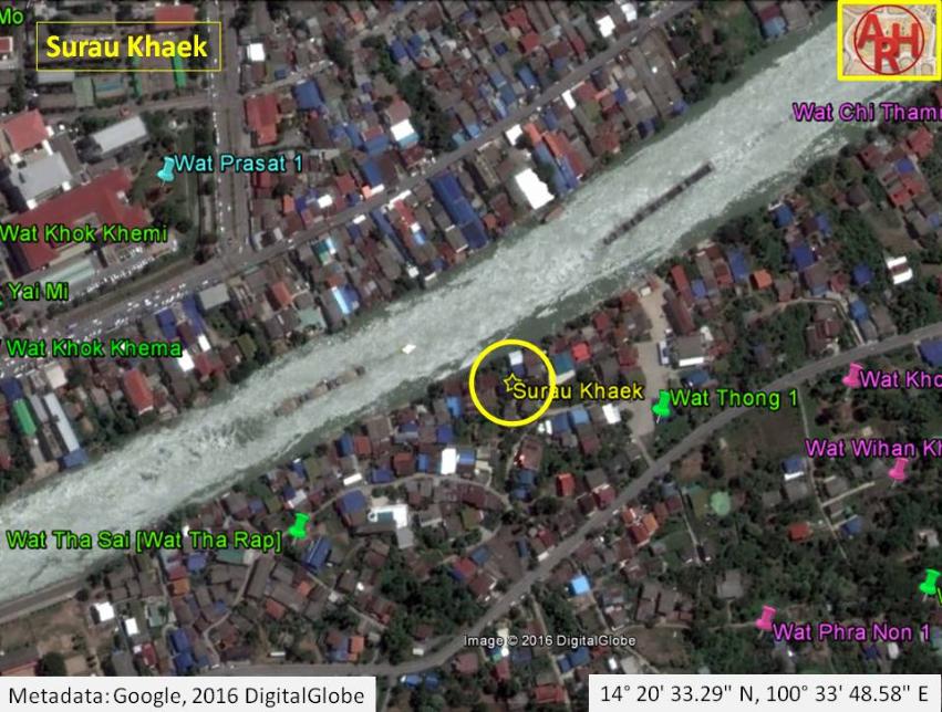
| The Surau Khaek was located off the city island in the southern area of Ayutthaya in Samphao Lom Sub-district. "Surau" is a Malay word for a small Muslim prayer hall or house, used for the daily prayers. It does not have the same status as the "masjid" (Arabic - place of prostration) or mosque, to be used for the special Friday prayers. A surau can be upgraded to a mosque, but a mosque can never be downgraded to a surau, even if the Muslim community builds a new mosque. It can be more or less compared with what is a chapel and a church for the Christians. The prayer house was situated at the entry of Khlong Khu Cham on its western bank. Behind the prayer house at the entry of the canal was one of the four large sized water markets of Ayutthaya. [1] The earliest indication I could find of the prayer house was on Francois Valentyn's map, Groote Siamse Rievier Me-Nam Of Te Moeder Der Wateren In haren loop met de vallende Spruyten Verbeeld. The map shows a "Moorse Tempel" or Moorish Temple on the west bank of the Khu Cham, although it seems not to be situated immediately at the entry of the canal. A mid-19th century map shows the prayer house at the entry of Khlong Khu Cham opposite Wat Thong. A hand drafted Monthon Krung Kao Military Map of 1916 shows in the same area the indication "Soat Khaek", but I am not sure if it refers to the old Surau Khaek or a post-Ayutthaya constructed mosque such as the Aliyinnuroi Mosque. In the area around the entry of Khlong Khu Cham are today at least two mosques and a prayer house. On the premises of the old Wat Thong stands the Islam Watthana Mosque. Opposite the road of the latter was the old Muslim cemetery, which was moved later to the present Chao Kun Khu Cham Cemetery. The Surau Khaek must have been approximately situated in geographical coordinates; 14° 20' 33.29" N, 100° 33' 48.58" E. Footnotes: (1) A local recounted in April 2016 during a visit to the area that quite a bit of human remains were found earlier in the area west and next to Wat Khok Sung. References: [1] Markets and Production in the City of Ayutthaya before 1767: Translation and Analysis of Part of the Description of Ayutthaya - Chris Baker - Journal of the Siam Society, Vol. 99, 2011 - page 65. |
| | | | | | | |
| | | | | | | |

| (Detail of François Valentyn's map published in 1724) |
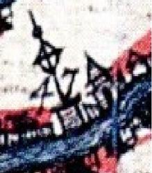
| (Detail of the Moorish Temple) |
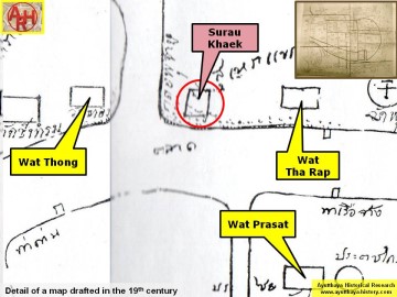
| (Detail of a 19th century map - Courtesy of the Sam Chao Phraya Museum - map is orientated S-N) |