
| | | | | | | |
| KHLONG KHUE NA (คูขื่อหน้า) |
| Text & photographs by Tricky Vandenberg - May 2012 |
| | | | | | |
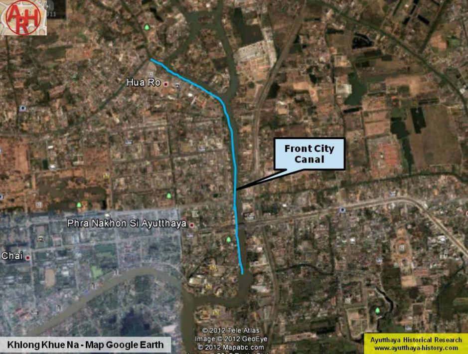
| Khlong Na Mueang or Khu Khue Na (Front City Canal) ran east of the city of Ayutthaya. The former moat is said to have been dug in the reign of King Ramathibodhi I also called King U-Thong. It was initially a defensive moat or could have been a separation ditch (border line) between the ancient city of Ayodhya situated in the oxbow of the Pa Sak River, and the new established city of Ayutthaya in the oxbow of the Lopburi River. The Royal Palace stood on the premises of the present ruins of Wat Phra Sri Sanphet and the earthen walls surrounding the city were likely not further than the moat, which became later known as Khlong Pratu Khao Pluak. In the mid-16th century the eastern city moat ran probably where is today Khlong Makham Riang (See Eastern city limits of Ayutthaya in 1569). After the first fall of Ayutthaya in 1569 and a series of attacks by the Khmers, King Maha Thammaracha (r. 1569-1590) extended the city walls to the riverbanks and to the eastern moat. The latter was dug 20 m wide and 6 m deep; and stretched out north towards the Mae Nang Plum Monastery and south to the mouth of Khlong Khao San (the milled rice canal). (2) In 924, a year of the dog, fourth of the decade, the King had the Royal Metropolis renovated. He had the moat by the front ramparts on the east dug ten wa wide and three wa deep from the Maha Chai Fort at the Back Palace down to connect with Kaca Village. Then he had the city walls moved out to the banks of the river, the outer limit of the Royal Metropolis, and connected with the Maha Chai Fort, and from the Maha Chai Fort connected down to the Phet Fort. [1] At the time of connecting the widened eastern defense moat with the Lopburi River near Wat Mae Nang Plum, the waters of the Lopburi preferred to take the new course straight down through the eastern moat (Khu Khue Na) towards the mouth of Khlong Khao San. Fearing that the old stretch of water along the northern side would become shallow, a weir was built, in order to block off the mouth of the ditch precisely in front of the Maha Chai Fortress. The waters of the Lopburi River still partly continued to flow north of the city and through erosion kept the oxbow in the Lopburi River at a constant depth. The Lopburi River encircled as thus the city of Ayutthaya at that time. During the Burmese attack of Ayutthaya in 1767, the weir in front of the Maha Chai Fortress collapsed. The waters of the Lopburi River poured down straight into Khlong Khue Na reducing the current of the Lopburi River in front of Wat Mae Nang Plum, which led to silting of this river stretch over time. A natural waterway, Khlong Ko Loeng, (1) coming from the area of Maha Rat and being a tributary of the Lopburi River, joined Khlong Khue Na in front of Chantra Kasem Palace. Another small canal, Khlong Sai, cutting through the eastern mainland joined Khlong Khue Na south of the palace grounds opposite Wat Prasat. A connection canal originating near Wat Pa Kho linked the Pa Sak River with Khlong Ko Loeng and likely Khlong Sai in front of Wat Tong Pu. Early 20th century the embankment in front of the Chantra Kasem Palace started to collapse as the waters of Khlong Ko Loeng (new Lopburi River) and the junction canal of the Pa Sak River collided with the waters of Khlong Hua Ro (old Lopburi River) forming a strong whirlpool which undercut the embankment. To reduce the mass of water in front of Chantra Kasem Palace, the Governor of Ayutthaya Phraya Boran Rachathanin, ordered the widening of Khlong Sai (which presumably had a connection with the Pa Sak River). The Pa Sak River changed its course and joined Khlong Khue Na below today's Ayutthaya Ship Building Industrial and Technology College ; as thus a large part of Khlong Khue Na, became the new riverbed of the Pa Sak River. Another canal having access to Khlong Khue Na was Khlong Pratu Ho Ratanachai. This canal was likely a defensive canal in the reign of King Chakkraphat, but incorporated into the city when the city walls were extended in the reign of King Maha Thammaracha. Along the left bank of Khlong Khue Na from Hua Ro till the mouth of Khlong Khao San were following sites: Wat Monthop, Wat Saphan Kluea, Wat Nang Chi, Wat Yom Mon, Wat Yom Thai, Wat Jan, Wat Phichai Songkhram and Wat Kluei. On the right bank stood the Maha Chai Fortress, Chantra Kasem Palace, Pom Wat Khwang and Wat Prasat. Footnotes: (1) A part of Khlong Ko Loeng will later become a stretch of the (new) Lopburi River. (2) In the Ayutthayan era the Pa Sak River ran through Khlong Khao San and had its mouth near Wat Phanan Choeng, where it joined the Lopburi River (the latter became the Chao Phraya River after 1857) near Bang Kaja (See The Quest for the Holy Water; Ayutthaya's Ever-Changing Waterways). References: [1] The Royal Chronicles of Ayutthaya - Richard D. Cushman (2006) - page 82 / Source: British Museum - Ayutthaya’s Fortifications Rebuilt, 1580. |
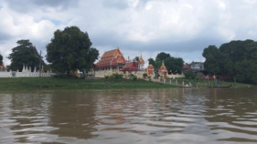
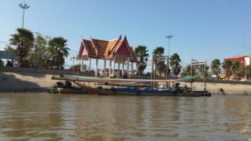
| (Wat Monthop on the left bank of the Front City Canal) |
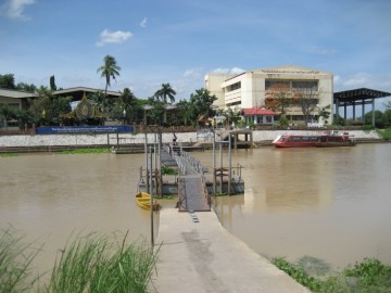
| (Foot bridge linking Ko Loi and the Ship Building Institute) |
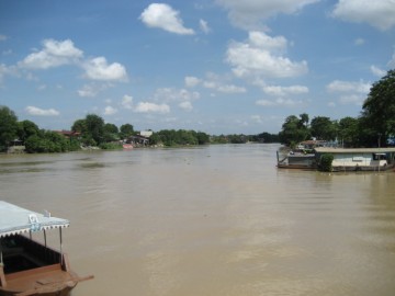
| (View of the Front City Canal from the Ship Building Institute) |
| (View of the Front City Canal from the Ayutthaya Ship Building Industrial and Technology College ) |
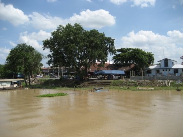
| (Wang Na Pier on the Front City Canal) |
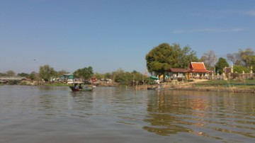
| (The Front City Canal) |