| AYUTTHAYA'S CITY WALLS |

| Text & photograps by Tricky Vandenberg Updated September 2016 |

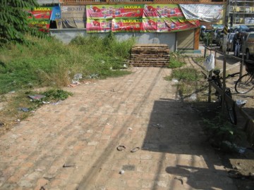
| (Remains of the wall on U-Thong Rd, opposite Wat Yan Sen - February 2009) |
| | | | | | | |
| | | | | | | |
| (Reconstruction of the old city wall near Hua Ro Market) |


| (Eastern city wall of Ayutthaya) |
| (Eastern city wall of Ayutthaya) |
| The location of the city of Ayutthaya had been chosen merely for its strategic position in the oxbow of the Lopburi River. The first wall round Ayutthaya built by King Ramathibodhi I (reign 1350-1369) was merely a moat-and-mound enclosure with wooden stakes driven into the ground on an earthen rampart. The city was surrounded on its northern, western and southern flanks by the Lopburi River, a natural barrier easily to protect. Only the eastern side of the city was prone to attack, as the Pa Sak River ran a few kilometers east in its old river bed; reason why a defensive moat was dug in the east - the Khu Na (front moat). When new canals were dug, the mud and debris were stacked on the bank; the mound serving a defensive purpose and cut down on flooding. This type of defense was used until the mid 16th century. The eastern defenses of Ayutthaya at that time were made up by a large moat and wooden enclosures and stretched only until the middle of today's city island. (1)[1] The large eastern moat became later known as Khlong Pratu Khao Pluak - Khlong Pratu Jin. At present this canal does not exist anymore, but still some traces remain of it on the premises of Wat Ratcha Pradit Sathan. |
| The first brick walls The city expanded and the eastern defense moat extended in the mid-16th century to the present Makham Riang Canal. The latter can be deduced from the writings in the Royal Chronicles of Ayutthaya, describing the first fall of the City of Ayutthaya (see: The eastern Ayutthaya city limits in 1569). In 911, a year of the cock, …... At that time the King had the walls of Ayutthaya built for the first time. (2)[2] In 1550, after the first attack of the Burmese in the reign of King Maha Chakkraphat (reign 1548-1569), the defenses of Ayutthaya were strengthened. [3] Prince Damrong wrote that King Chakkraphat realized that Ayutthaya had entered the age of gunpowder and large guns came to dominate the war theater and thus strengthened the defenses of the city by a series of construction works. The construction of Pom Phet and Pom Sat Kop at the main waterway intersections, dates from this period. The city walls were reinforced and redone in brick (brick does not shatter on impact from a cannon ball as stone does). A crenellated wall of laterite, brick, and plaster was constructed on wooden beams beneath, serving as foundations and done to stop invading armies from trying to tunnel beneath the defense wall. (3)[4] |
| The brick city walls extended In 924, a year of the dog, fourth of the decade, the King had the Royal Metropolis renovated. He had the moat by the front ramparts on the east dug ten wa wide and three wa deep from the Maha Chai Fort at the Back Palace down to connect with Kaca Village [Canal?]. Then he had the city walls moved out to the banks of the river, the outer limit of the Royal Metropolis, and connected with the Maha Chai Fort, and from the Maha Chai Fort connected down to the Phet Fort. [5] Ayutthaya was conquered for the first time on 30 August 1569 and temporarily became a vassal state of Burma. Even under the watchful eyes of the Burmese, King Maha Thammaracha (reign 1569-1590) was allowed to build new walls around the city under the pretext of a threat from Cambodia. (4)[6] The new walls were extended to the riverbanks in 1580. The moat by the front ramparts on the east - the Khu Na - was dug 20 meters wide and 6 meters deep and extended towards the Mae Nang Plum Monastery and the mouth of Khlong Khao San. (5) The Maha Chai Fortress was built (6) at the confluence of the Lopburi River and the newly dug shunt connecting the Khu Na or Front City Moat for the defense of the north-eastern side of the city. [7] Likely Portuguese engineers contributed to the thicker and better reinforced style of walls. Brick forts were constructed, to replace the old fortifications. Known fortresses were Pom Maha Chai, Pom Sat Kop, Pom Phet and Pom Ho Racha Khrue. Pom Phet’s location at the confluence of the Chao Phraya and Pa Sak Rivers near Hua Sarapha, protected the harbour where foreign ships anchored for inspection and unloading, while Pom Sat Kop guarded the north-western part of the city at the confluence of the Maha Phram Canal and the Lopburi River near an area called Hua Laem. The walls of Ayutthaya were restored by King Prasat Thong (1630-1655) in 1634. Jeremias Van Vliet, a merchant of the Dutch East India Company wrote: The town …. is surrounded by a heavy stone wall which has a length of more than two Netherlands miles. This wall was for the greatest part renewed in 1634 and provided with a heavy stone footing. [8] The Sicilian Jesuit and architect who built the San Paolo Church in the old Portuguese enclave, Father Tommaso Valguarnera (1608-1677), was asked by King Narai (reign 1656-1688) in 1663 to rebuild the walls of Ayutthaya. He was replaced as superior by Father Cardosa in order to take care of this task and was occupied with the construction of fortifications until 1670. In 1675, on his return to Siam, we find Fr. Valguarnera again occupied with building the walls of Ayutthaya until his death in 1677. [9] The maintenance of these brick walls seemed to have been an ever ongoing issue as Nicolas Gervaise wrote around 1686 that a new wall was built. The year coincides with the presence of the French self-made 'engineer' de la Mare, who was part of the first French Embassy to Siam under de Chaumont and de Choisy in 1685. He remained at King Narai's request in order to build fortifications. (7) The enclosure of the city is only about two leagues, and this includes the royal palace. It is more oval than round and is girt by a brick wall, which is falling into ruin. However, the king is having a new wall built, which is not yet completed. [10] In 1760 the Burmese armies invaded Siam. The ex-King Uthumphon (reign 1758), who retired to a monastery leaving the kingdom to his elder brother, disrobed in 1760 on request of the people to take care of the defenses of Ayutthaya. He had a second wall built in front of the Grand Palace. The foundations of this second wall rest today under a part of the U-Thong Rd between Wat Thammikarat and Khlong Tho. Now the walls of the municipality along the front of the Holy Royal Palace Enclosure on the side toward the edge of the river originally consisted of only a single tier. He had one more tier of walls newly constructed outside and lower than the original walls. And He had teak logs brought up, tied to hang from the boundary stones and pounded into the ground to form barriers to seal off all the water and land gates. [11] |
| (Northern palace wall being part of the city wall) |
| After the fall of Ayutthaya (1767) Most parts of the wall and the forts were dismantled in the reign of King Rama I (reign 1782 - 1809), who had the bricks taken to be used in the construction of the city walls for the new capital in Bangkok. [12] In 1784 bricks from the ruins of Ayutthaya were used to construct a barrage in the Lat Pho Kanal at Phra Pradaeng to halt the intrusion of saline water farther inland. [13] Another round of building material gathering occurred in the reign of King Rama III (reign 1824 - 1851) when remaining bricks and laterite stones including those of the Thamnop Ro causeway and the Elephant Bridge, were sent down to Bangkok to be used in the construction of a giant stupa, a copy of Ayutthaya's Chedi Phukhao Thong. Unfortunately Wat Saket collapsed into rubble. The remains of the crumbled chedi were remodeled in the reigns of Rama IV and V, to become known as the Golden Mount today. |

| (The chedi Phukhao Thong at Wat Saket, former Wat Sakae, before it was remodeled) |
| The remaining foundations of Ayutthaya's city wall disappeared in 1895 when the Governor of Ayutthaya, Phraya Chai Wichit Sitthi Satra Maha Pathesathibodi, ordered the construction of U-Thong road; the present road encircling the city island of Ayutthaya. Today there are only a few - mostly reconstructed - remnants left of the old city wall. Early 20th century documents such as Phraya Boran Ratchathanin's Explanation of the map of the Capital of Ayutthaya (1929) mention that the walls around the city were built, some with brick, some with laterite, and some with red stone. The wall from ground level to the top of the parapet was 6 meters. Inside the walls there was a raised earthwork for patrolling inside the walls, 3 meters high and 5 meters wide with passageways. (8) There were forts, camps, moats, and large and small gates around the city. The long side of the city wall was over 4 Km and the short side over 2 Km. [14] Another source writes that archaeological evidence from the Diamond Fort (Pom Phet) indicates that the first walls were up to 6.5 meters in width. They consisted of brick inside and outside, while the interior was filled with rubble. The later city walls presumably built in the reign of King Narai were only 1.5 meters in width and 6.5 meters in height from ground level up to crenellations. [15] |
| Footnotes: (1) We find here in 1424 Phraya Ai and Phraya Yi fighting for the throne near Pa Than Bridge. We can presume the two armies encountered each other in front of the city wall, not within the city. (2) 911 Chula Sakarat (CS) = 1549 Anno Domini (AD). AD = CS + 638. (3) The technique of "mining" was used in warfare to bring down fortifications not built on solid rock. A tunnel was excavated under the outer defenses either to provide access into the fortification or to collapse its walls. The tunnels were supported by temporary timber supports as the digging progressed. When the excavation was completed, the wall or bastion which was undermined would be brought down by filling the excavation hole with combustible material. The combustibles when lit, would burn away the pit props, leaving the structure above unsupported and thus liable to collapse. It is in this way that in 1767 the walls near the Maha Chai Fortress were breached by the Burmese. (4) Wars with Lovek in 1570, 1575, 1578, 1581 and 1582. (5) Possibly at that time a shunt between the Lopburi and Pa Sak rivers was cut and the front city moat or Khu Na became the actual course of the Pa Sak River. (6) The Maha Chai Fort was first mentioned in the Royal Chronicles of Ayutthaya during the White Elephant War of 1563-64. If the date in the chronicles is correct, then the fort must have defended the north-eastern part of the city. The fort stood likely not in its last known location, but in the axis of the Khlong Makham Riang (Nai Kai) Canal, which was at that time the eastern city wall, and more or less were the Jampa Phon Fort was situated. Prince Damrong wrote that the Maha Chai Fort was erected around 1580, when the connection shunt was dug between the Lopburi River and the Khu Na (eastern front moat). There is as thus a discrepancy in the Royal Chronicles of Ayutthaya. [Cushman, Richard D. - The Royal Chronicles of Ayutthaya (2006) - page 35 / Source: Phan Canthanumat, British Museum, Reverend Phonnarat, Phra Cakkraphatdiphong & Royal Autograph - The Narai Sanghan Cannon] (7) De La Mare was initially embarked to teach piloting to the marine guards of the embassy, and apparently was not a trained engineer in France. Het was although a gifted self-made man and fell soon in the taste of Constantine Phaulkon. On arrival of the second French Embassy in 1687 - which was carrying four "Ingenieurs du Roi" to the French general Desfarges - the works at the fort in Bangkok were already ongoing, de La Mare found him soon at loggerhead with Jean Vollant des Verquains, one of the four engineers working in Siam in 1687-1688. (8) Other sources (the testimonies) give only a height of 8 'sok' (4 meters) and indicate no width. References: [1] Charnvit Kasetsiri & Michael Wright - Discovering Ayutthaya (2007) - page 320. [2] Cushman, Richard D. -The Royal Chronicles of Ayutthaya (2006) - page 28 / Source: Luang Prasoet - Elephants, Construction, and Rituals, 1549-1550. [3] Wood, William A.R. - A History of Siam (1924) - page 114. [4] Rajanubhab, Damrong (Prince) - Our Wars with the Burmese (1917) - Re-edited White Lotus (2001) - page 66. [5] The Royal Chronicles of Ayutthaya - Richard D. Cushman (2006) - page 82 / Source: British Museum. Ayutthaya’s Fortifications Rebuilt, 1580. [6] Wood, William A.R. - A History of Siam (1924) - page 128-30. [7] Rajanubhab, Damrong (Prince) - Our Wars with the Burmese (1917) - Re-edited White Lotus (2001) - page 66. [8] Baker, Chris - Van Vliet’s Siam (2005) - page 6. [9] Cerutti, Pietro S.J. - The Jesuits In Thailand - Part I (1607 - 1767) [10] Gervaise, Nicolas - The Natural and Political History of the Kingdom of Siam - chapter 10 / page 31. [11] Cushman, Richard D. - The Royal Chronicles of Ayutthaya (2006) - page 480 / Source: Royal Autograph - Royal Younger Brother Leaves Monkhood to Assist the Defence. [12] Rajanubhab, Damrong (Prince) - Our Wars with the Burmese (1917) - Re-edited White Lotus (2001) - page 10. [13] Tanabe, Shigeharu - Historical Geography Of Canal System In Chao Phraya River Delta - Journal of the Siam Society (JSS) 65 - page 41, [14] Phraya Boran Rachathanin - Athibai Phaenthi Phra Nakhon Sri Ayutthaya kap khamwinitjai khong Phraya Boran Racha Thanin - Explanation of the map of the Capital of Ayutthaya with a ruling of Phraya Boran Rachathanin - Revised 2nd edition and Geography of the Ayutthaya Kingdom - Ton Chabab print office - Nonthaburi (2007). [15] Charnvit Kasetsiri & Michael Wright (2007) - Discovering Ayutthaya - Toyota Thailand Foundation - page 321. |