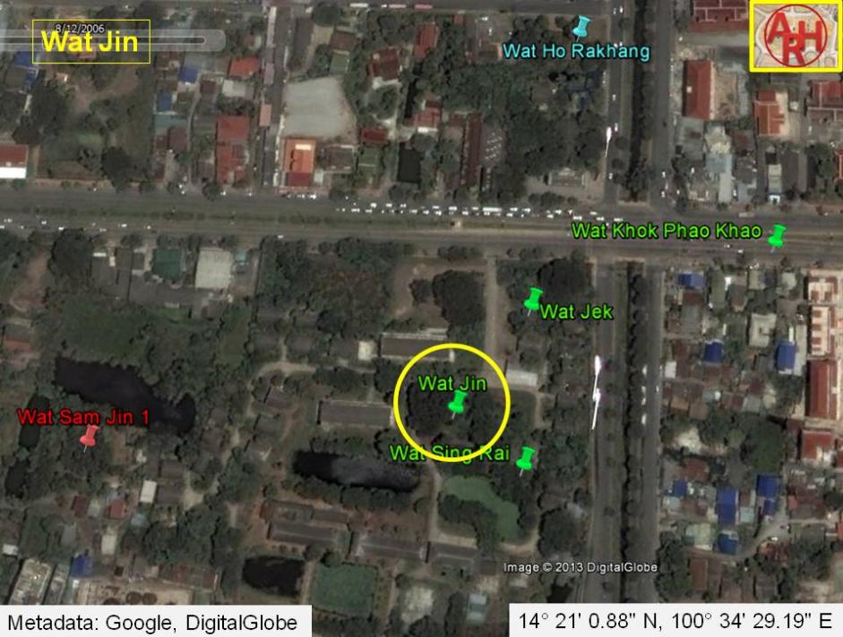
| WAT JIN 1 (วัดจิน) |
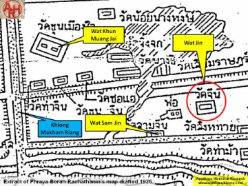
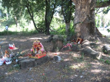
| Wat Jin (Chinese Monastery) might be a disappeared temple. It appeared on Phraya Boran Rachathanin's (1926) map. The first Fine Arts Department tourist map (1957) mentioned a Wat Tha Non Cheen (Wat of the Chinese Harbour) in an approximate area. It was also listed on the Fine Arts Department tourist map of 1997. There are some contradictions as to its exact location. Nevertheless, this temple would have been located along Khlong Nai Kai (present Khlong Makham Riang) on the property of where a Women's Dormitory stands today. Khlong Pratu Chin - now buried - once flowed through this area along an east-west axis toward the Chinese Gate (Pratu Chin). It isn't clear when Wat Jin was originally founded. Chinese maritime traders settled in this harbour/warehouse area along a road known as China Street. China Street is documented on the French map by Sieur de La Mare (1751). Engelbert Kaempfer added in 1727 that China Street was made of brick and included some of the best houses in the city (p 44). In addition to the Chinese population, these houses also belonged to French, Dutch, Muslim, and English merchants. It is not clear what this temple looked like, nor do we know if it was just a basic joss house or shrine. No trace of it can be seen for certain. There exists a rectangular mound just north of Wat Tha Ma in which a temple was once located. There are a few sections of Buddha images stacked next to a tree as evidence. A second rectangular mound can be seen east of this site, but it has eroded down to only a few bricks. One of these locations might be the remains of Wat Jin, but more research is needed to be sure. This temple probably "disappeared" as a new population moved into the neighborhood during the Ratanakosin period. Given its location near the harbour, it could have been a casualty from the period in which King Rama I and King Rama III removed to Bangkok to build a new capital. During the post-Ayutthaya period, a teacher training college for women was located close by. This explains why this old temple is situated on a women's dormitory property today. |

| | | | | | | | |
| Text by Ken May - April 2009 |
| | | | | | | |
| Addendum The site is located in geographical coordinates: 14° 21' 0.88" N, 100° 34' 29.19" E. Making an assessment of all the monastic structures, in the zone demarcated by Chikun Road, Pa Thon Road, Pridi Banomyong Road and U-Thong Road is rather difficult, as the position and name of the structures vary on different maps. On a 19th century map, there are 15 structures counted, while on the 20th century PBR map there are 13 mentioned. There is inconsistency in the names and the positions. Even maps drafted by the Fine Arts Department, what I presume, based on excavations in the zone, shed no light on this matter. Positions of monastic structures can be asserted, but their ancient names will remain questioned forever. |
| Photograph, maps & addendum by Tricky Vandenberg May 2014 |
| (View of the former location of Wat Jin) |
| (Detail of Phraya Boran Rachathanin's map - Anno 1926) |
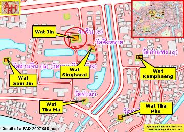
| (Detail of a 2007 Fine Arts Department GIS map - Courtesy of the Fine Arts Department - 3th Region) |