| WAT KRAJI (วัดกระจี) |
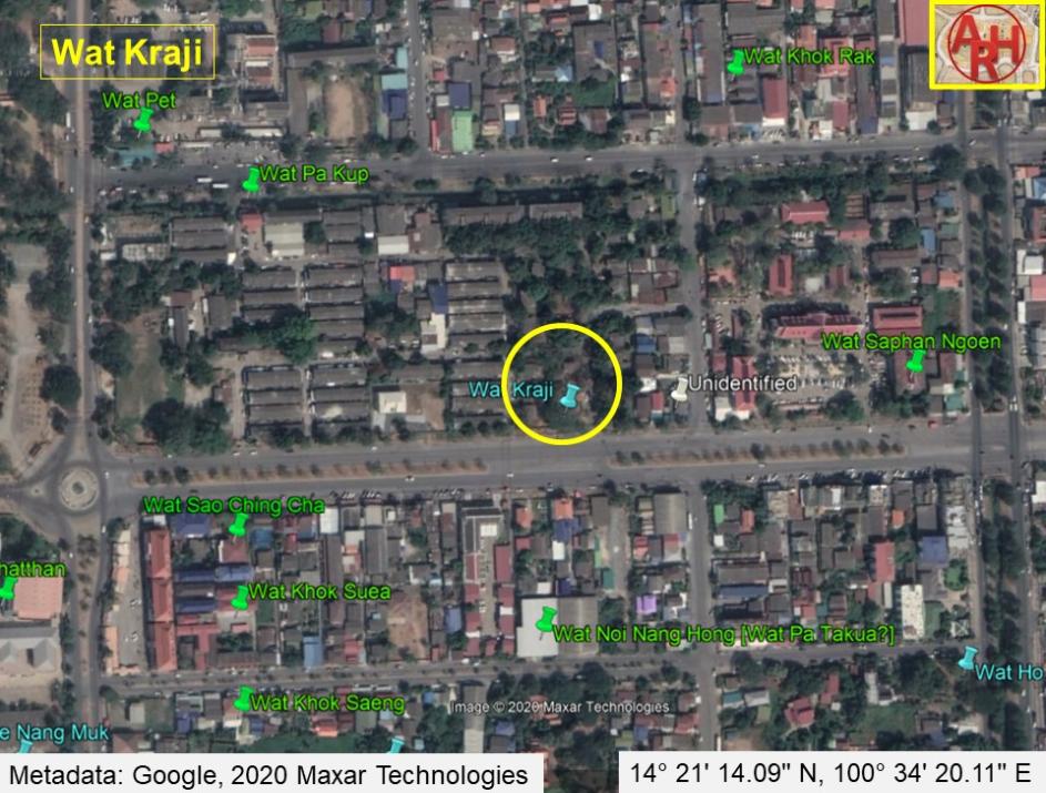
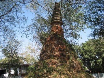
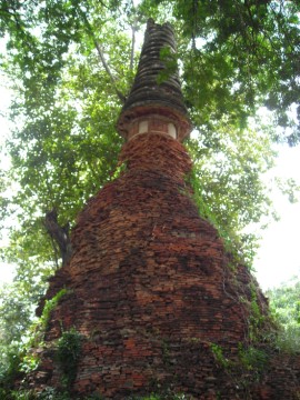
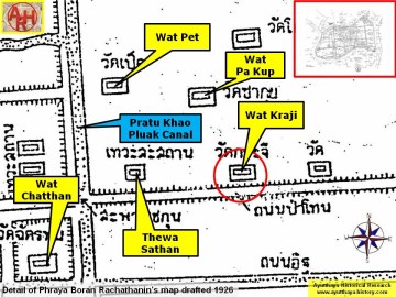
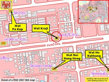
| Wat Kraji is a restored ruin of a monastery that is situated along the northern side of Pa Thon Road. It can be found on the property of the Provincial Police Headquarters. This monastery is sometimes hidden by heavy vegetation, but a good landmark for finding it is the post office on the opposite side of the road. A large bell-tower is the only structure in situ at Wat Kraji. The layers of stucco have almost all peeled away, but the spire is still in good condition. There are at least 19 rings around the spire. The finial is missing, and the shape of the harmika is observable but badly eroded. Looters have dug a large hole in the northern side of the chedi, which reveals is a large and hollow inner chamber. The base has lost most of its shape. However, it appears as if some foundation layers are still situated below ground level. Red bricks are scattered around the site, but I could still not find remnants of any walls or other structures. Wat Kraji was once located beside an old road leading from east to west, and evidence suggests it was accessed exclusively by foot rather than by boat. Wat Kraji is most likely one of the unnamed pagodas on de La Mare’s 1751 map. This map shows a monastery on the northern side of a road, which is situated slightly above a canal running from east to west. The temple is between Khlong Pratu Khao Pluak and Khlong Nai Kai (Khlong Makham Riang). This unnamed pagoda perfectly matches the geographic location of Wat Kraji. |

| | | | | | | | |
| Text by Ken May - August 2009 Photographs & maps by Tricky Vandenberg Updated December 2014 |
| | | | | | | |
| (The chedi of Wat Kraji) |

| (Detail of a 19th century map - Courtesy of the Sam Chao Phraya Museum) |
| (Detail of Phraya Boran Rachathanin's map - Anno 1926) |
| (Detail of a 2007 Fine Arts Department GIS map - Courtesy of the Fine Arts Department - 3th Region) |


| (The chedi of Wat Kraji) |