| WAT LAT (วัดลาด) |
| Wat Lat (also known as Chaiyaphum and Chaiya Bhumi) is located south of the former Pa Than bridge and the Chedi Ay and Chedi Yi memorials. The area is known as the Pratu Chai District, and it is the location of an old market site that sold wood charcoal for fires - hence, the temple's former name (Temple of the Charcoal Bridge). The ground plan or base of the brick chedi is square. The bell-shaped dome (anda) and cube-shaped reliquary (harmika) are badly damaged, while the nine-tiered umbrella roof (chatra) is in slightly better shape. The main building with its entrance to the east was likely a sermon hall, as no traces of boundary stones were found on the site. Specific here is that the brick building was surrounded by a series of chedi, which (like the boundary stones) had the function of warding off evil spirits. A fairly large face of a Buddha image has survived. It is perched in the sermon hall next to stacks of debris from other Buddha images. Traces of the monastery's outer wall are not visible. The temple's main historic relevance concerns a battle for royal succession in 1424. King Intharaja I had three sons, named according to the old numerical system (Ay = first, Yi = second and Sam = third). On their father's death, in 1424, the two elder sons, Phraya Ay living in Suphanburi, and Phraya Yi leaving in Phraek Siracha, fought for their father's throne in Ayutthaya. Ay and his adherents were stationed at Wat Chai at the Coconut grove (Pa Maphrao), while Yi and his people held up at Wat Chaiyaphum. Both princes engaged each other in personal combat, mounted on elephant, on or near the "charcoal forest" bridge (Saphan Pa Than) - just north of the temple. Both were severely wounded and died from combat wounds. The youngest brother, Phraya Sam, who was living in Chainat, was then proclaimed King under the title of Boromaracha II. This deserted monastery is most often covered in thick vegetation today, and packs of biting dogs live nearby; therefore, it is better to visit the site with caution and to enter via Ho Ratanachai Rd. |

| | | | | | | | |
| Text by Ken May - April 2009 |
| | | | | | | |
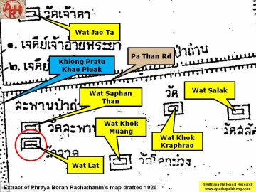
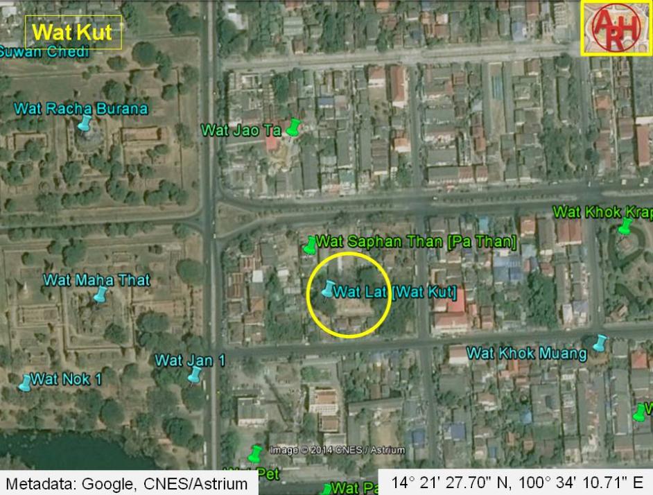
| Addendum Wat Lat or the Inclined Monastery is indicated on a map drafted in the mid-19th century and on Phraya Boran Rachathanin's map of 1926. Based on an overlay made of the mid-19th century map, the position of Wat Lat is located much more south compared with the ruin which we call today Wat Lat; and the monastery stands more or less where Phraya Boran Rachathanin (PBR) situates Wat Pet on his 1926 map. The mid-19th century map indicates the existence of a prang on an indented square base, but on the present position of Wat Lat we find a chedi. On the position where PBR indicates Wat Lat, we find on the mid-19th century map, a monastery called Wat Kut. This monastery is indicated with a chedi. It could be an indication that the Wat Lat of today was called Wat Kut two centuries ago. It is obvious that there were different monastic structures in this area and their denomination remains unfortunately a bit of guesswork. Historical data about Wat Lat and its construction are not known. The site is situated in geographical coordinates: 14° 21' 25.94" N, 100° 34' 11.96" E. |
| Addendum & photographs by Tricky Vandenberg - January 2011 Updated December 2014 |
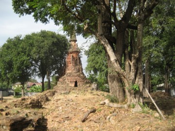
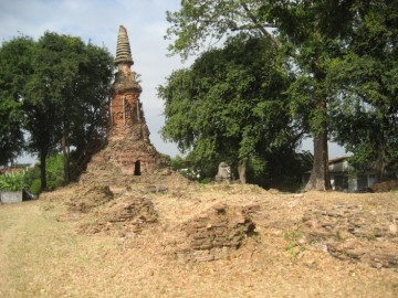
| (Wat Lat from the East) |
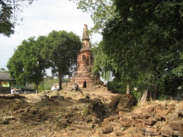
| (View chedi and ubosot from the East) |
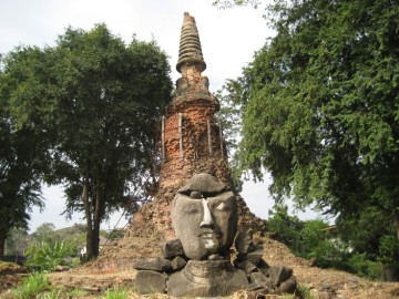
| (View of a Buddha head on the ruins of the ubosot) |


| (View chedi and ubosot from the East) |
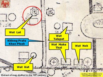
| (Detail of a 19th century map - map is orientated S-N) |
| (Detail of Phraya Boran Rachathanin's map - Anno 1926) |
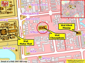
| (Detail of a 2007 Fine Arts Department GIS map - Courtesy of the Fine Arts Department - 3th Region) |

| (Source: Phra Rachawang lae Wat Boran nai Jangwat Phra Nakhon Sri Ayuthaya - 2511. Courtesy of the Fine Arts Department - 3th Region) |