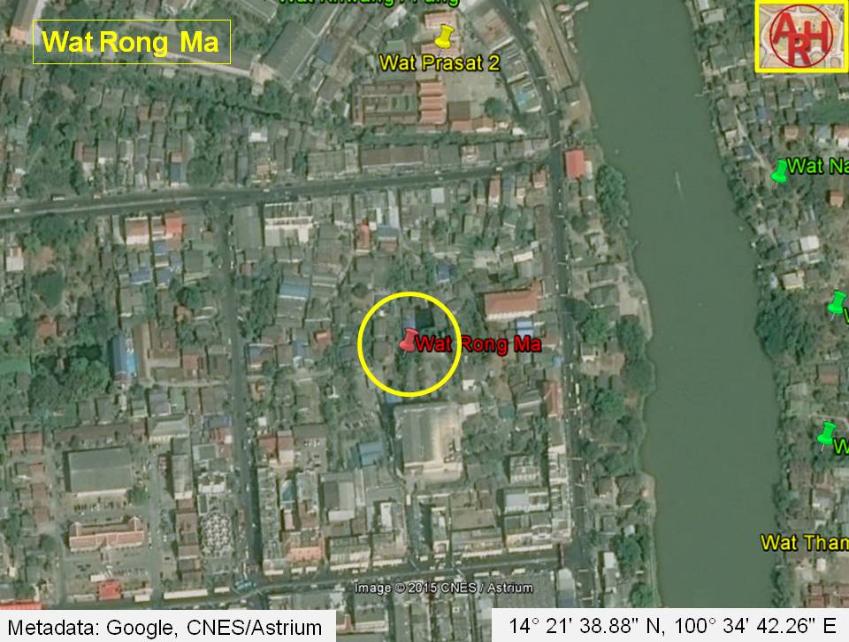
| WAT RONG MA / KHOK MA (วัดโรงม้า) |
| Wat Khok Ma is located on the city island on a side alley directly off of "Farang Street". Hundreds of tourists walk by it everyday without ever knowing it is there. The ruin has been fenced off by private land owners, but it is possible to walk inside for a better view. There are particularly feisty dogs patrolling the side street, so enter with caution. There aren't many structures remaining in situ at Wat Khok Ma. The primary feature is a badly dilapidated chedi. A single Buddha image in a meditating pose has been placed on top of this makeshift shrine, and a tin roof has been added to protect it from the elements. A second structure is also on the premises. This appears to be a small and heavily eroded chedi. This monastery is covered by a lot of vegetation, but there are hints of some boundary walls. More excavation would be useful. This temple ruin is named after a horse stable that was once located at this site. The horses used to bathe at the Pa Sak River and Khlong Maprao. A second but smaller horse stable was located beside the Royal Palace east of Wat Phra Si Sanphet. There were many horses living in the city. French visitor Simon de La Loubère wrote, "the King of Siam keeps two thousand horses: He has a dozen of Persian, which are now nothing worth" (de La Loubère 39). The Siamese military had an awkward relationship with horses. Horses spooked the elephants, so they had to be separated. The Siamese military ranked the cavalry (Krom Brah Asvaraja) as a lesser subdivision of the Elephant Department (Krom Brah Gajapala). However, horses still played an important role in warfare. In 1581, (during the reign of King Maha Thammaracha) a Siamese army of 150,000 men with 800 elephants and 1,800 horses invaded Cambodia (Wales 154). Persian traders brought Arabian-bred horses to Siam as gifts. However, the Persians were appalled at the Siamese treatment of their beloved animals. One Persian envoy, Ibn Muhammad Ibrahim, writes that the Siamese cut the manes and tails off horses since they were consider bad luck. Siamese also forced horses into a submissive posture with their heads tucked between their front legs because it was considered insulting for horses to raise their heads (O’Kane 85). The vicinity of Wat Khok Ma has taken on a new dynamic in present times. The area has become a major tourist zone known as “Farang Street”. As a result, several guest house owners have expressed interest in formally renaming the road after this monastery. Another interesting side note concerns some expatriates who lived near Wat Khok Ma in the early 1990s. While gardening in the area they dug up a large head of a Buddha image, and they also found a number of human bones in situ. The landlady claimed that this site was used for dumping the cremated remains of unclaimed bodies: prisoners, homeless, and other disenfranchised that were too poor for a proper ceremony. The story has been confirmed by a large number of people living in the neighborhood. |

| | | | | | | | |
| Text & photographs by Ken May - Aug 2009 |
| | | | | | | |
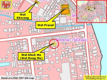
| Addendum On a map drafted in the mid 19th century the monastery is called Wat Rong Ma or the Monastery of the Horse Stable (วัดโรงม้า). The temple was located between Wat Jan and Khlong Pratu Ho Ratana Chai and also situated between two roads; the northern one longing the canal from Pratu Ho Ratanachai towards the Chang Bridge (a road presently called Thanon Maphraw; and the southern one leading from Pratu Jao Jan to the Pa Than Bridge in the immediate vicinity of Wat Maha That and Wat Racha Burana (a road presently called Thanon Naresuan). The mid-19th century map indicates no existence of a chedi nor a prang. Also Phraya Boran Rachathanin called this monastery Wat Rong Ma on his map drafted in 1926. On a map drafted in 1993 by the Fine Arts Department, the monastery was renamed Wat Khok Ma for unknown reason. |
| Addendum & maps by Tricky Vandenberg - November 2010 Updated April 2015 |
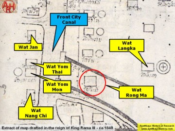
| (Detail of a 19th century map - map is orientated S-N) |
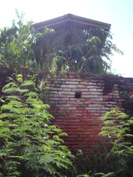
| (Remaining brick work of Wat Rong Ma) |
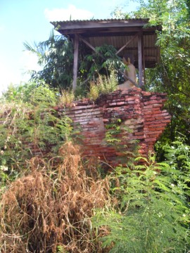
| (Remaining brick work with Buddha image at Wat Rong Ma) |
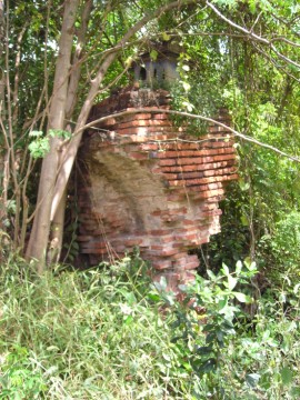
| (Remaining brick work of Wat Rong Ma) |
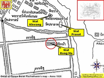
| (Detail of Phraya Boran Rachathanin's map - Anno 1926) |
| (Detail of a 2007 Fine Arts Department GIS map - Courtesy of the Fine Arts Department - 3th Region) |