| WAT SAM JIN 1 วัดสามจีน |
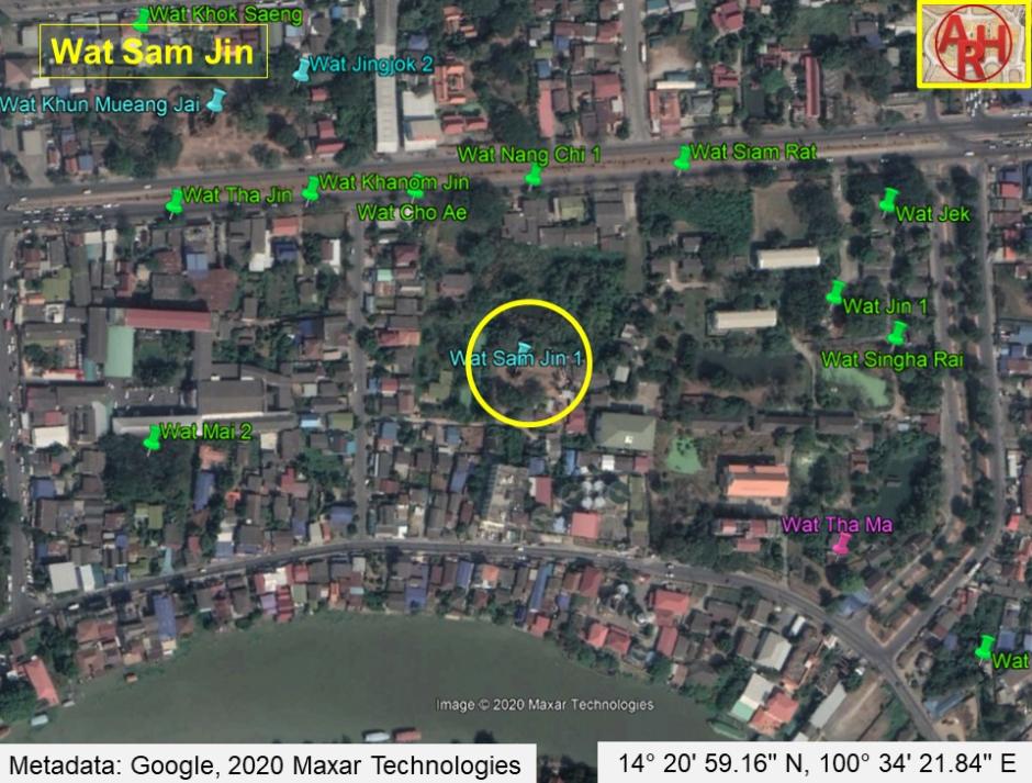
| Wat Sam Jin is located on the city island, outside of the historic park, between Rojana Rd and the southern portion of U-Thong Rd. The closest modern landmark is the Nam Chai apartment building. This deserted ruin can be found on a small, unnamed, side street after much difficulty. In fact, I lived next to it for nearly four years without ever seeing it. This temple ruin was once connected to a chain of Chinese pagodas near Khlong Pratu Jin. This canal - now buried - once flowed along an east-west axis toward the Chinese Gate (Pratu Jin), intersecting with Khlong Pratu Khao Pluak (the canal that once flowed in front of Wat Maha That). Wat Sam Jin also appears on Phraya Boran Rachathanin's (1926) map next to a second canal leading to a swamp adjacent to Wat Khun Mueang Jai. This swampland is still visible behind Wat Sam Jin. It isn't clear when Wat Sam Jin was originally founded. Chinese maritime traders settled in this area in abundance. A nearby road was referred to as China Street, and this is documented on the French map by Sieur de La Mare (1751). Engelbert Kaempfer added in 1727 that China Street was made of brick and included some of the best houses in the city (p 44). In addition to the Chinese population, these houses also belonged to French, Dutch, Muslim, and English merchants - including Constantine Phaulkon. Wat Sam Jin may also appear on the Dutch map of Vingboons (1665). The temple still hasn't been restored. All that is left of Wat Sam Jin today is a large chedi tower and basic foundation layers. The tower is hollow and square with a few simple redentations. There are traces of stucco remaining in places. The tower hints of a late-period prang style. The sermon hall has mostly crumbled into a mound. The general size and shape can still be deduced, but future excavation would reveal much more beneath the surface. There are many roof tiles scattered around that date to the King Narai period and the usual stack of headless Buddha images. The modern neighborhood is heavily populated with a Chinese-Thai community (mostly from a Teochiu background). Most of them settled here after land purchases became legally available in 1936. |

| | | | | | | | |
| Text by Ken May - May 2009 |
| | | | | | | |
| Addendum Wat Sam Jin or the Monastery of the Three Chinese is located on Ayutthaya's city island in Pratu Chai Sub-district in the vicinity of former Pratu Jin (Chinese water gate - now obsolete) and in the middle between Khlong Pratu Jin (defunct) and Khlong Nai Kai, a canal now called Khlong Makham Riang. On a 1974 Fine Arts Department (FAD) map the monastery is referred to as Wat Khanom Jin or the Monastery of the Thai Rice Noodle. A 2007 FAD digital map indicated both names Wat Sam Jin and Wat Khanom Jin. On 7 October 2011 in the evening Ayutthaya fell to the floodwaters from the Lop Buri, Pa Sak and Chao Phraya rivers. The water spilled into the city and flooded the city island. Water seeped into the foundations of the chedi of Wat Sam Jin and the structure crumbled on 10 October, reducing the tower to a pile of bricks. Another old ruin bites the dust in the Historic City of Ayutthaya. Wat Sam Jin was excavated and restored the years after the 2011 flood. The restored ruin of Wat Sam Jin is located in geographical coordinates: 14° 20' 59.16" N, 100° 34' 21.84" E. |
| Text, maps & photographs by Tricky Vandenberg Updated April 2015 |
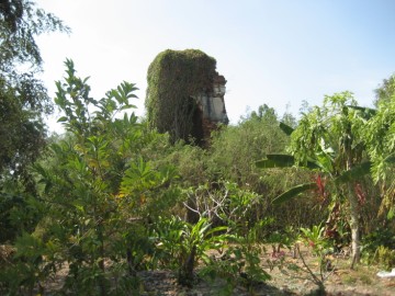
| (View of the tower from the south) |
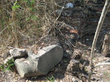
| (Remains of a fragmented Buddha statue) |


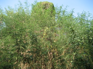
| (Wat Sam Jin covered in vegetation) |
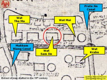
| (Detail of a 19th century map - map is orientated S-N) |
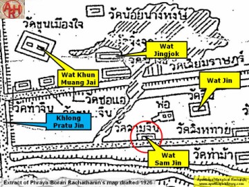
| (Detail of Phraya Boran Rachathanin's map - Anno 1926) |
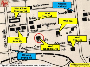
| (Detail of a 1974 Fine Arts Department map - Courtesy Dr. Surat Lertlum, Chulachomklao Royal Military Academy) |
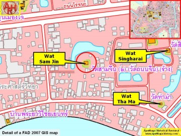
| (Detail of a 2007 Fine Arts Department GIS map - Courtesy of the Fine Arts Department - 3th Region) |