| WAT SASADA (วัดศาสดา) |
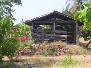
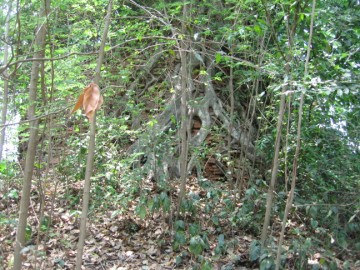
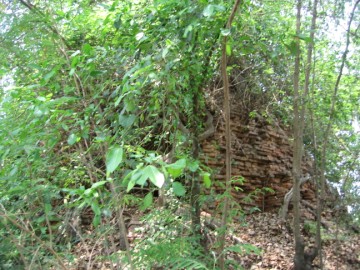
| Wat Sasada is located on private property north of the main island. It was accessible by a tributary canal of Maenam Pho Sam Ton, also known as Khlong Bang Khuat. Locals now refer to this canal informally as Khlong Wat Tum, which is the closest landmark. A large bell shaped chedi still stands at this site. This is heavily covered in vegetative growth. An enormous Bodhi tree engulfs a large portion from its tip all the way to the foundation layer. A hole has been dug into its relic chamber by looters. There are sections of headless Buddha images beside the chedi and a large number of scattered bricks. A brick mound exists on private property near this site. This may have served as a sermon hall at one point. The history of this monastery is unknown. The style of chedi hints that it may have been constructed during the middle Ayutthaya period. A number of battles were fought with the Burmese in this area, and it is plausible that its construction is connected to this warfare. |

| | | | | | | | |
| Text & photograph 1 by Ken May - April 2009 |
| | | | | | | |


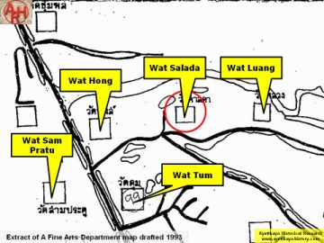
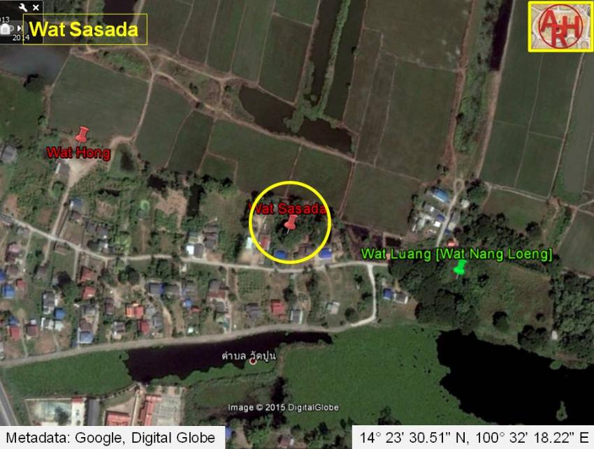
| Addendum Wat Sasada or the Monastery of the Holy Teacher is situated off the city island in the northern area of Ayutthaya in Wat Tum sub-district, Moo 3. The monastery features on a 1993 and a 2005 Fine Arts Department map. On the 1993 map it is named as Wat Salada (วัดศาลดา). Some remains of the temple were excavated by the Fine Arts Department (FAD) in geographical coordinates: 14° 23' 19.17" N, 100° 32' 22.56" E (based on 2007 map). In my opinion this position is incorrect as a ruin was found - called by the locals Wat Sasada - in geographical coordinates: 14° 23' 30.51" N, 100° 32' 18.22" E. Wat Sasada stood north of Wat Tum and in between Wat Hong and Wat Luang. The temple was situated within a loop of the old Lopburi River of which the southern part is at present called Khlong Wat Tum. At a certain moment a short cut or 'khlong lat' had been dug to straighten the Lopburi River. The latter canal was called Khlong Bang Khuat referring to the village Ban Bang Khuat in which vicinity the canal was dug. |
| Addendum, maps & photographs by Tricky Vandenberg Updated May 2015 |
| (Detail of a 1993 Fine Arts Department map - Courtesy Khun Supot Prommanot, Director of the 3th Regional Office of Fine Arts) |
| (Brick mound in situ) |
| (Remains of a chedi) |
| (Remains of a chedi) |
| (Roots climbing up the structure) |
| (Remaining brick work) |
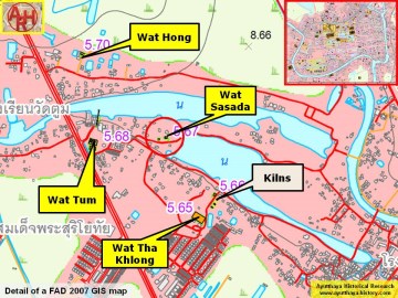
| (Detail of a 2007 Fine Arts Department GIS map - Courtesy of the Fine Arts Department - 3th Region) |