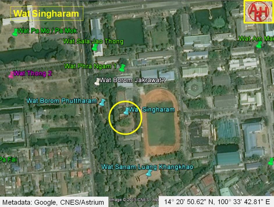
| WAT SINGHARAM (วัดสิงหาราม) |
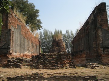
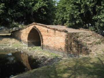
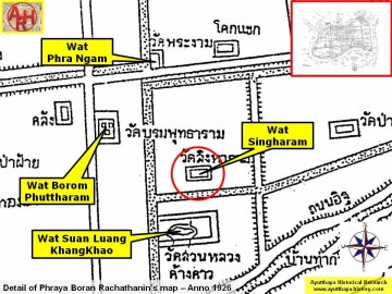
| Wat Singharam or the Monastery of the Lion is a restored ruin located on the city island in Pratu Chai Sub-district, on the Rajaphat Institute premises, south of Rojana Road. The monastery stands opposite Wat Borom Phuttharam on the east bank of Khlong Chakrai Noi. The ruins of Wat Suan Luang Khangkhao are situated south of Wat Singharam on the same canal bank. The site consists of a sermon hall (vihara), two bell-shaped chedi, chedi rai and a mandapa. Its historical background and period of construction are unknown. It was possibly built in the Middle Ayutthaya period (1488 - 1629 AD) and was restored in the Late Ayutthaya period (1629 - 1767 AD). Fragments of Chinese porcelain decorated with stucco designs were found at the entrance in front of the vihara. This type of decoration was found back on some other monuments restored in King Borommakot's reign (r.1733-1758). A mid-19th century map indicates this temple as Wat Kot (วัดกด), probably making a reference to King Borommakot. The position of Wat Kot being identical to Wat Singharam on this map, matches the present location of the ruins (Wat Suan Luang Khangkhao and Wat Borom Phuttharam) around Khlong Chakra Noi The Fine Arts Department reconstructed the brick bridge over the remaining stretch of Khlong Chakrai Noi in the vicinity of Wat Borom Phuttharam and Wat Singharam. This bridge is called Taphan Sing (ตพานสิง) or Lion Bridge on the mid-19th century map. Phraya Boran Rachathanin's map drafted in 1926 indicated a canal between Wat Singharam and Wat Wat Suan Luang Khangkhao, leading from Khlong Chakrai Noi towards Khlong Pratu Thep Mi. This canal is not found on the mid-19th century map. |

| | | | | | | | |
| Text, maps & photographs by Tricky Vandenberg Updated February 2011 |
| | | | | | | |

| (View of the ubosot) |
| (Chedi rai on the temple premises) |
| (The Sing Bridge over Khlong Chakrai Noi) |
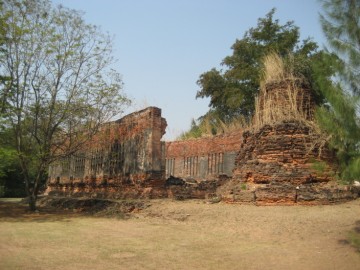
| (View from the east) |
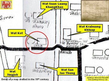
| (Detail of a 19th century map - Courtesy of the Sam Chao Phraya Museum - map is orientated S-N) |
| (Detail of Phraya Boran Rachathanin's map - Anno 1926) |
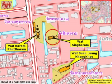
| (Detail of a 2007 Fine Arts Department GIS map - Courtesy of the Fine Arts Department - 3th Region) |