| WAT SONG KHON (วัดสองคน) |
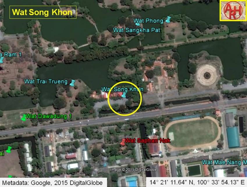
| Wat Song Khon or the Monastery of the Two People (?) can hardly be called a ruin as only parts of the outer wall are remaining. The monastery was located on the city island, south of Bueng Phra Ram, and north of Pa Thon Rd, just opposite the Ayutthaya Witthayalai School. Wat Phong stood in the north, Wat Saphan Nak in the south and Wat Trai Trueng in the west. The monastery was located along Talaeng Kaeng Street, at present part of Pa Thon Rd and a road leading to the Phra Kalahom Landing. The latter road was running parallel with the Lam Khu Pak Sra canal. The site is indicated on a map drafted in the mid-19th century and on Phraya Boran Rachathanin's map of 1926. The 19th century map depicts the defunct Khlong Thep Mi, west of the monastery, as thus effectively sitting on its eastern bank; while Phraya Boran Rachathanin draws the Thep Mi canal east of the temple. The oldest map indicates the existence of a chedi. Its historical background and period of construction are unknown. Wat Song Khon was located in geographical coordinates: 14° 21' 11.64" N, 100° 33' 54.13" E. (*) The monastery has been categorized as a restored ruin, because there still exists some brickwork, restored by the Fine Arts Department. . |

| | | | | | | | |

| | | | | | | |
| Text, maps & photograph by Tricky Vandenberg Updated July 2015 |

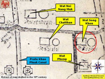
| (Detail of a 19th century map - map is orientated S-N) |
| (Detail of Phraya Boran Rachathanin's map - Anno 1926) |
| (Brick remnants of Wat Song Khon) |

| (Detail of a 2007 Fine Arts Department GIS map - Courtesy of the Fine Arts Department - 3th Region) |