Wat Cho (1) is located on the city island in the southwest area in the Pratu Chai Sub-district, northwest of the Somdet Phra Sri Nakharin Park. The location is part of the Ayutthaya Historical Park. The temple's ruins lay east of U-Thong Rd, more or less opposite Wat Chai Watthanaram. The ruins can be easily reached.
Wat Cho stood on the south bank and near the mouth of Khlong Tha Phra (2). At the mouth was a water-gate called Pratu Khlong Tha Phra and a boat landing in connection with Wat Lot Chong, called Phra Racha Wang Lang Landing.
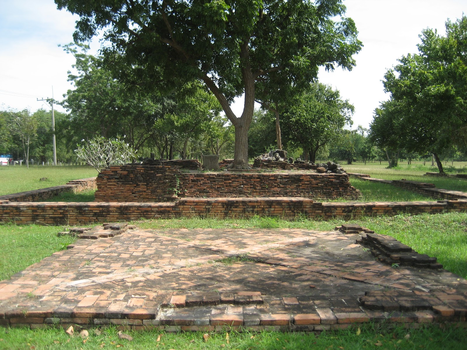
The monastery's foundations are still visible, being likely from a sermon hall. No traces of boundary stones were found. The entry of the hall is to the east. The floor of the main chedi is situated on the west side of the hall. The hall was surrounded by an inner wall, while an outer wall protected the whole complex.
The history and period of the construction of Wat Cho are unknown.
Wat Cho shows on a mid-19th century map in a similar position on Phraya Boran Rachathanin's (PBR) map drafted in 1926 CE, east of Wat Phra Ngam. Wat Maha Saman was situated south. On the oldest map, Wat Chang was located opposite, on the north bank of the canal but PBR indicates a cluster of four temples.
The site is in geographical coordinates: 14° 20' 45.64" N, 100° 32' 44.10" E.
Footnotes:
(1) Cho (เฉาะ.) = to chop, break or slit open or (เฉาะ ๆ) = comfortable.(2) Khlong Tha Phra, also known as Khlong Klaep, is a defunct canal situated on Ayutthaya's city island. Some stretches of this old canal still can be seen today on the western side. The canal had its mouth at the old Lopburi River today renamed the Chao Phraya River. Here stood one of the eleven water gates around the island called Pratu Khlong Tha Phra. The canal ended at the confluence with Khlong Chakrai Yai. Beyond this confluence, it continued in an eastern direction as Khlong Pa Mo and joined the Pratu Thep Mi Canal. There is evidence that this canal continued eastwards in a straight line to join Khlong Makham Riang.