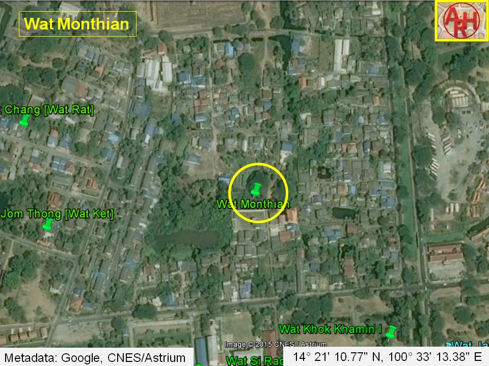
Wat Monthian, or the Monastery of the Royal House, was located on the city island in the western area of Ayutthaya in the Pratu Chai Sub-district.
The temple was located south of an ancient canal called Khlong Chang Maha Chai, stood south of Wat Lokaya Sutharam and east of Wat Jom Thong.
There are no traces anymore of the former monastery above ground level. I classified the temple thus as defunct.
Maps
On the 19th-century map drafted by an unknown surveyor, Wat Ratcha Monthian stood south of the Chang Maha Chai Canal (1) and north of Lao Road with two other temples Wat Wang Chai in the southwest and Wat Ket in the northwest. A large pond was located in the south, and Wat Lokaya Sutha was north opposite the Chang Maha Chai Canal. The site is marked with the presence of a chedi.
The site is mentioned on Phraya Boran Ratchathanin’s [PBR] map drafted in 1926 CE in more or less the same position as on a mid-19th century map. PBR has Wat Jom Thong in place of Wat Ket on the mid-19th century map, shows the Maha Chai Granary in the northwest along the canal, but does not indicate Wat Wang Chang.
Historical data about the monastery and its construction are unknown.
Wat Monthian was located in geographical coordinates: 14° 21' 10.77" N, 100° 33' 13.38" E.
Footnotes:
(1) Khlong Chang Maha Chai or the "Maha Chai Granary Canal" was a small waterway running east-west. It had the mouth at the old Lopburi River (at present the Chao Phraya River) in front of Wat Thamma and linked up with Khlong Pak Tho. The canal passed the fortified city wall at the Chang Maha Chai Gate, a large water gate between Wat Suan Luang and Wat Sop Sawan. The canal has been filled up somewhere after the fall of Ayutthaya (1767 CE), and no traces of the waterway are left today.
(2) The Maha Chai Granary was the granary of the Rear Palace. It was located between Wat Ket and Wat Monthian along the Chang Maha Chai Canal.