
| | | | | | | |
| KHLONG KRAMANG (คลองกระมัง) |
| Text & photographs by Tricky Vandenberg - June 2010 Reviewed March 2011 |
| | | | | | |
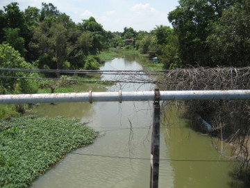
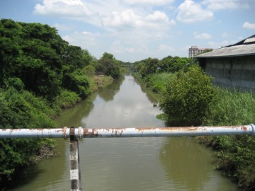
| Khlong Kramang flows on the border between Hantra and Phai Ling sub-district. It covers the stretch between Khlong Hantra and Khlong Ban Bat. At par with Khlong Hantra, Khlong Dusit and Khlong Khao San, this canal was once a stretch of the Pa Sak River [1]. Khlong Kramang houses an active Buddhist monastery on its south bank being Wat Phraya Tikaram. Three more monasteries were situated along this canal: the vanished Wat Jula Mani on its south bank, the vanished Wat Tha Pho on its north bank and the still existing - by the FAD restored - ruin of Wat Nang Kham. Wat Tha Pho and Wat Nang Kham were also situated respectively on the west and east bank of Khlong Doem/Kudi Dao, a canal arriving from the north (1). Running east of Khlong Doem / Khlong Kudi Dao and parallel with it, Khlong Maheyong arrived from the north, linking the Maheyong monastery and its neighbors with Khlong Kramang. The canal is named after a common fish in the Siamese waters, the Smith's Barb (ปลากระมัง) (2) Khlong Kramang can be paddled by kayak as part of the Hantra kayak trip. A description of the trip can be found on this web site under the section "kayaking". Footnotes: (1) Also called Khlong Dusit. (2) Puntioplites Proctozysron. References: [1] Our Wars with The Burmese - Prince Damrong Rajanubhab (1917) - Re-edited White lotus (2000). |
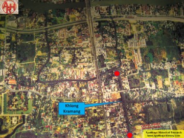
| (Aerial canal view) |
| (Canal view) |
| (Canal view) |