| WAT SOP SAWAN (วัดศพสวรรค์) |

| | | | | | | | |
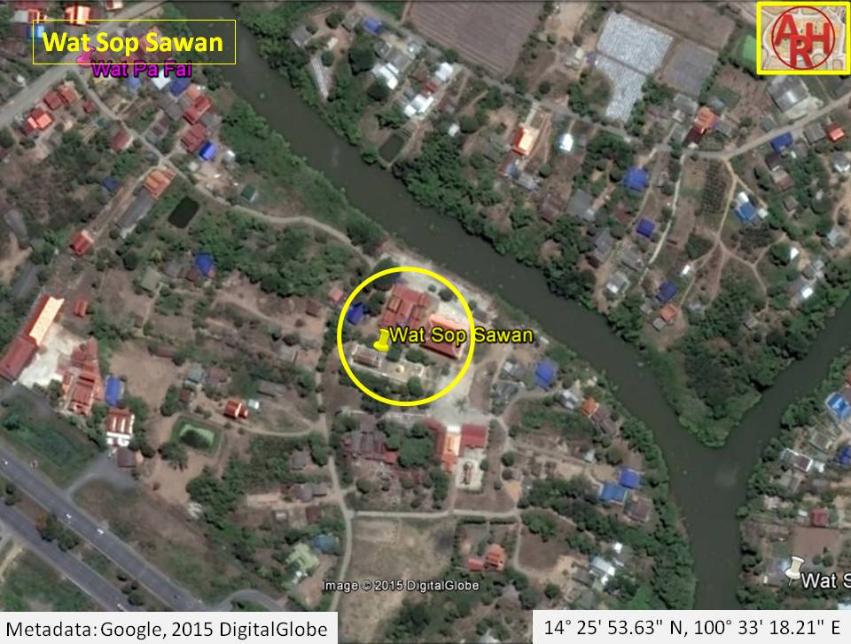
| Wat Sop Sawan or the Monastery of the Heavenly Corpse is an active monastery located off the city island in the northern area of Ayutthaya in Pho Sam Ton Sub-district of Bang Pahan in Ayutthaya Province. The temple is situated near the confluence of the Lopburi River and Khlong Ko Loeng on the right bank of the first. The story goes that in the Ayutthayan Era a boat accidentally capsized in the Lopburi River with a princess on board. The lady fell in the river, but nobody dared to drag her out of the water as at that time the law forbade commoners to touch a member of the royal family on pain of death penalty. The lady drowned and her body was swept away by the river. People living in the vicinity of the place of accident found her body about 1600 meters downstream (which lead to the suggestion that the capsizing occurred at the confluence of Khlong Thom or the Lam Lao, just south of Wat Khai). The palace officials were informed and the corpse retrieved from the river. The funeral and cremation of the late princess was done at the spot and a monastery was established as a memorial on the cremation site. The temple was called Wat Sop Sawan Pak Nam (วัดศพสวรรค์ ปากน้ำ), but known locally as Wat Pak Nam Phra Sop ( ปากน้ำประสบ), Wat Pop Sop (พบศพ) or Wat Pho Sop (โพสพ). The finder of the body of the deceased princess, being part of a group of Lao immigrants, received the title of Phraya Thai Nam (พระยาท้ายน้ำ - Downstream Lord) and the area was called Ban Lao thereafter. During the Burmese attack on Ayutthaya in 1767, Ban Lao was vacated and the monastery destroyed in the fight between Phraya Tak and the Mon-Burmese of Pho Sam Ton camp. After the war, the Lao returned and rebuilt their temple. During the reign of King Chulalongkorn, the villagers of Ban Muang ordered the construction of an ordination hall. Chinese workers built the hall and instead of returning home, they settled down near Wat Sing. The monastery flourished under the wealthy man Nai Son until 1897 AD. After that date decay set in and the temple was left by the monk hood in 1907 AD. As the community in the area grew, the temple was rebuilt in 1937 and called Wat Sop Sawan until today. Wat Sop Sawan is situated in geographical coordinates: 14° 25' 53.11" N, 100° 33' 19.04" E. |
| Text & images by Tricky Vandenberg - December 2012 Updated July 2015 |
| | | | | | | |
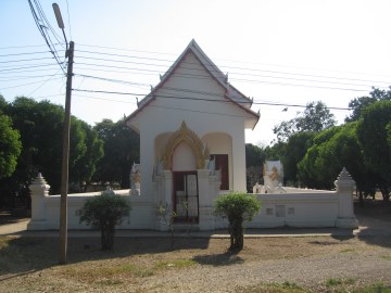
| (The ordination hall of Wat Sop Sawan) |