| WAT WIHAN THONG (วัดวิหารทอง) |
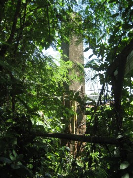
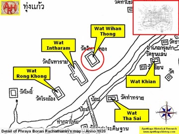
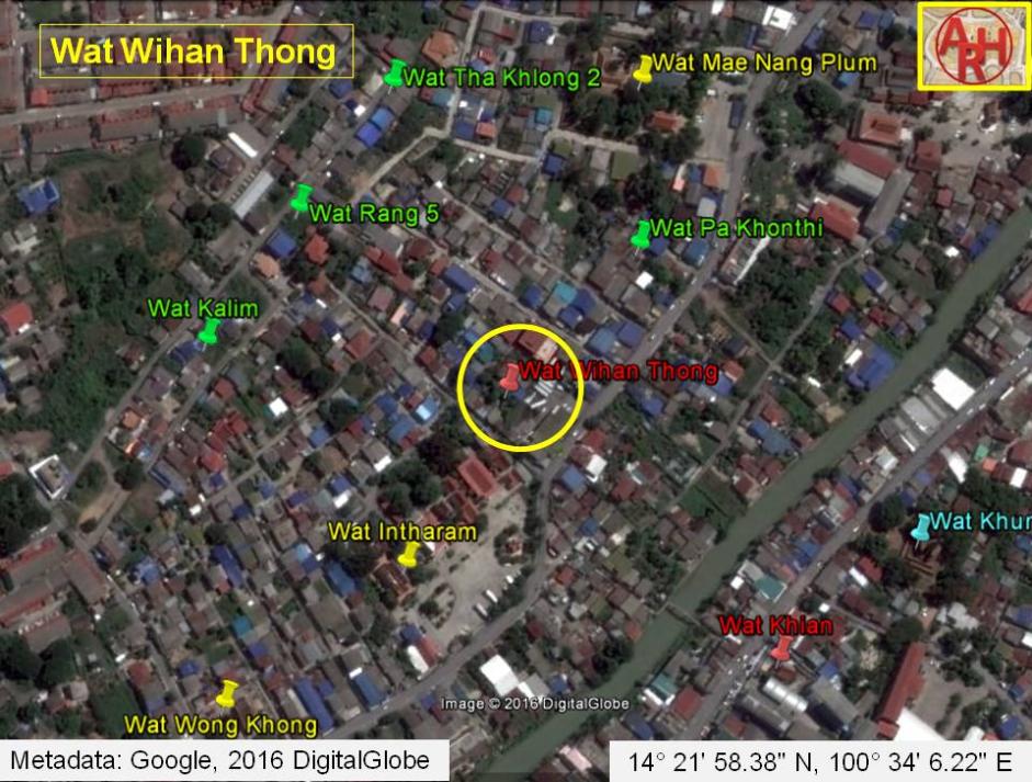
| Wat Wihan Thong or the Monastery of the Golden Vihara was located off the city island in the northern area at Hua Ro Sub-district. The temple was situated on the west bank of the old Lopburi River, presently called Khlong Mueang or City Canal. Wat Wihan Thong is situated north-east of Wat Intharam on private grounds. The temple stood opposite Wat Khian on the other bank of the river. Most of the monasteries along the old Lopburi were accessible by the water, but their premises have been split up last century due to the construction of a road from Wat Mai Khlong Sra Bua towards the Elephant Kraal. This is the case with Wat Kuti Thong, Wat Wong Khong and Wat Mae Nang Plum. In situ is a brick mound, with still some pillars, likely from the ordination hall, still standing. They can only be accessed through the small street adjacent to Wat Intharam and via a small path in between the stilt houses. The ruins are situated in the back garden of the latter. A chedi and an old Bodhi tree can be found on the premises of a private bus company. The chedi is twenty-rabbeted-angled, an architectural style from the second part of the Late Ayutthaya period (1629 - 1767 A.D.), sometimes called the Fourth period. This period starts with King Borommakot's ascendancy to the throne in 1733 A.D. and lasts until the Ayutthaya kingdom was devastated by the Burmese in 1767 A.D. King Borommakot (r. 1733-1758) was determined to renovate the old religious structures rather than building new ones and he restored many ancient monasteries and monuments. Historical data about the monastery and its construction are unknown. The site is indicated on a mid-19th century map and on Phraya Boran Rachathanin's map drafted in 1926. The ruins of Wat Wihan Thong are situated in geographical coordinates: 14° 21' 58.38" N, 100° 34' 6.22" E. |

| | | | | | | | |
| | | | | | | |
| Text & photographs by Tricky Vandenberg - March 2010 |


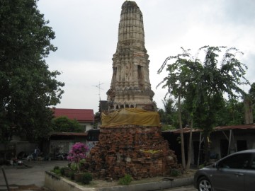
| (A remaining chedi from Wat Wihan Thong) |
| (Close-up from the remaining chedi from Wat Wihan Thong) |
| (Broken Buddha image pieces) |
| (Remaining brickwork) |
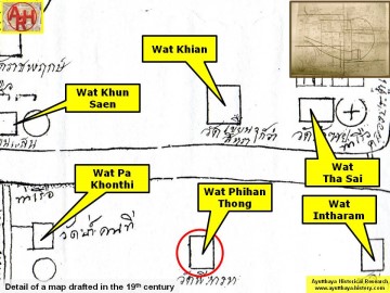
| (Detail of a 19th century map - Courtesy of the Sam Chao Phraya Museum - map is orientated S-N) |
| (Detail of Phraya Boran Rachathanin's map - Anno 1926) |
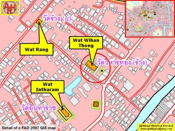
| (Detail of a 2007 Fine Arts Department GIS map - Courtesy of the Fine Arts Department - 3th Region) |
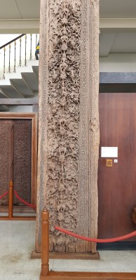
Wooden door panels in Ayutthaya Style dating back to
the 16-18th century and originated from Wat Wihan
Thong. Displayed at the Chao Sam Phraya National
Museum in Ayutthaya.
the 16-18th century and originated from Wat Wihan
Thong. Displayed at the Chao Sam Phraya National
Museum in Ayutthaya.