| LAM HOEI BRIDGE |
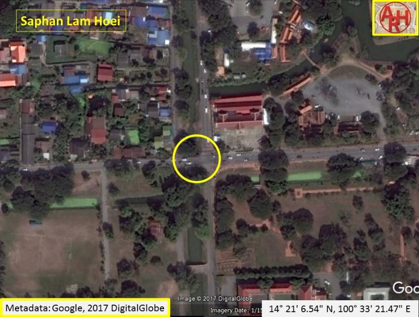
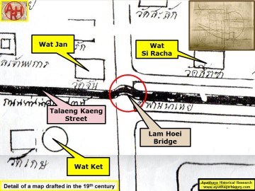
| Saphan Lam Hoei (Lit: the Bridge of the Wry Waterway) is located on the city island in Pratu Chai Sub-district. The structure can be found at the crossing of the present Pa Thon Road with Khlong Tho Road. The remains of the old bridge are situated under the present wooden bridge. The brick bridge was built over Khlong Tho - Khlong Chakrai Yai, a canal which was a shortcut in the loop of the old Lopburi River. Today the canal starts in Khlong Mueang or City Canal in the north (adjacent the ancient Grand Palace) and has its mouth at Pratu Chakrai Yai in the Chao Phraya River in the south. The bridge stood north-northeast of the today defunct Wat Khok Khamin. The remains of the foundations of this bridge became visible in 2017, when the Fine Arts Department made archaeological excavations along Khlong Tho - Chakrai Yai and encountered some brickwork. The bridge connected the road coming from Ayutthaya's ancient ring road behind the Rear Palace in the west - called Thanon Law or "Lao Street" - with Thanon Talaeng Kaeng or the "Street of the Gallows", connecting further east with Thanon Pa Thon. There was a fresh market called Lam Hoei Market to the east of the bridge in the Ayutthaya period. [1] The Lam Hoei Bridge is visible on Kaempfer's map published in his book The History of Japan (1727). [2] References: [1] Phanna phumisathan Phra Nakhon Sri Ayutthaya: Ekasan jak Ho Luang - Geographical description of Ayutthaya: Documents from the palace - Dr. Vinai Pongsripian - Bangkok, Usakane, n. d. (2007). [2] Kaempfer, Engelbert (1727) - The History of Japan (Together with a Description of the Kingdom of Siam) - London, John Gaspar Scheuchzer. Consulted works: [1] Athibai phaenthi Phra Nakon Sri Ayuthaya - Phraya Boran Rachathanin (1908). [2] Phaenthi Krung Sri Ayutthaya - Phraya Boran Rachathanin (1926). [3] Discovering Ayutthaya - Charnvit Kasetsiri & Michael Wright (2007) - Toyota Thailand Foundation. |
| Text & photographs by Tricky Vandenberg - November 2009 Updated May 2017 |
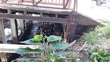
| (Brick foundations of the Lam Hoei bridge) |
| | | | | | | |
| | | | | | | |

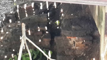
| (Brick foundations of the Lam Hoei bridge) |
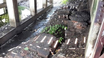
| (Brick foundations of the Lam Hoei bridge) |
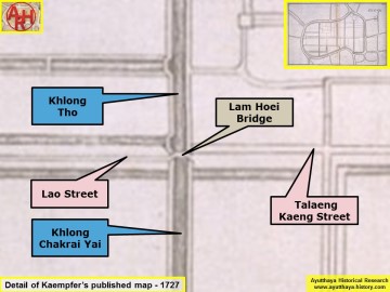
| (Detail of Engelbert Kaempfer's Published map - Anno 1727) |
| (Detail of a 19th century map - Courtesy of the Sam Chao Phraya Museum - map is orientated S-N) |