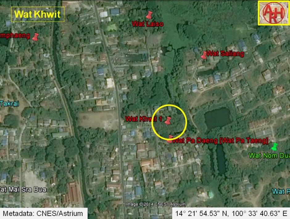
| WAT KHWIT 1 (วัดขวิด) |
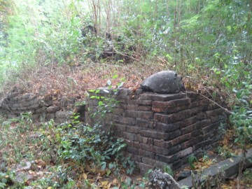
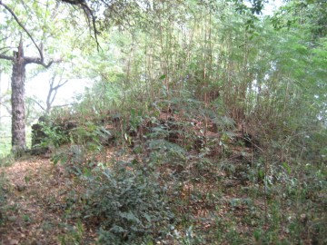
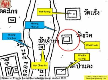
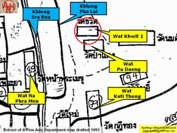
| Wat Khwit or the Monastery of the Horn was located off the city island in the northern area of Ayutthaya in Khlong Sra Bua Sub-district. The monastery was situated in between Khlong Pha Lai and Khlong Ban Pla Mo in area called before Thung Kaeo. Wat Pa Daeng stood in the south, while Wat Saliang was in the northeast, opposite Khlong Ban Pla Mo. Phraya Boran Rachathanin's 1926 map shows Wat Raeng on the north side of Wat Khwit, but this is not correct as it is generally accepted that Wat Raeng stood north of Wat Laiso. Wat Laiso is two hundred meter north of Wat Khwit. The indication of Wat Chao Ya at the level of Wat Khwit proved also incorrect. Wat Khwit was surrounded by water; the two canals in the east (Khlong Pla Mo) and west (Khlong Pha Lai) and the connecting canals in the north and the south, the latter separating Wat Khwit from Wat Pa Daeng. In situ we still find traces of this monastery. Brickwork and scattered bricks recalls it past. Historical data about the monastery and its construction are unknown. The site is indicated on Phraya Boran Rachathanin's map [PBR] drafted in 1926 as on Fine Arts Department maps drafted in 1974 and 1993. The ruin is situated in Geo Coord: 14° 21' 54.53" N, 100° 33' 40.63" E. |

| | | | | | | | |
| | | | | | | |
| Text, maps & photographs by Tricky Vandenberg - July 2010 Reviewed January 2012 |
| (Remaining brickwork in situ) |
| (Brick mound) |


| (Detail of Phraya Boran Rachathanin's map drafted in 1926) |
| (Detail of a 2007 Fine Arts Department GIS map - Courtesy of the Fine Arts Department - 3th Region) |