| WAT PA SATHON (วัดป่าสะท้อน) |

| | | | | | | | |
| Text & maps by Tricky Vandenberg - October 2009 Updated April 2011, April 2013, February 2015 |
| | | | | | | |

| (Detail of Phraya Boran Rachathanin's map - Anno 1926) |
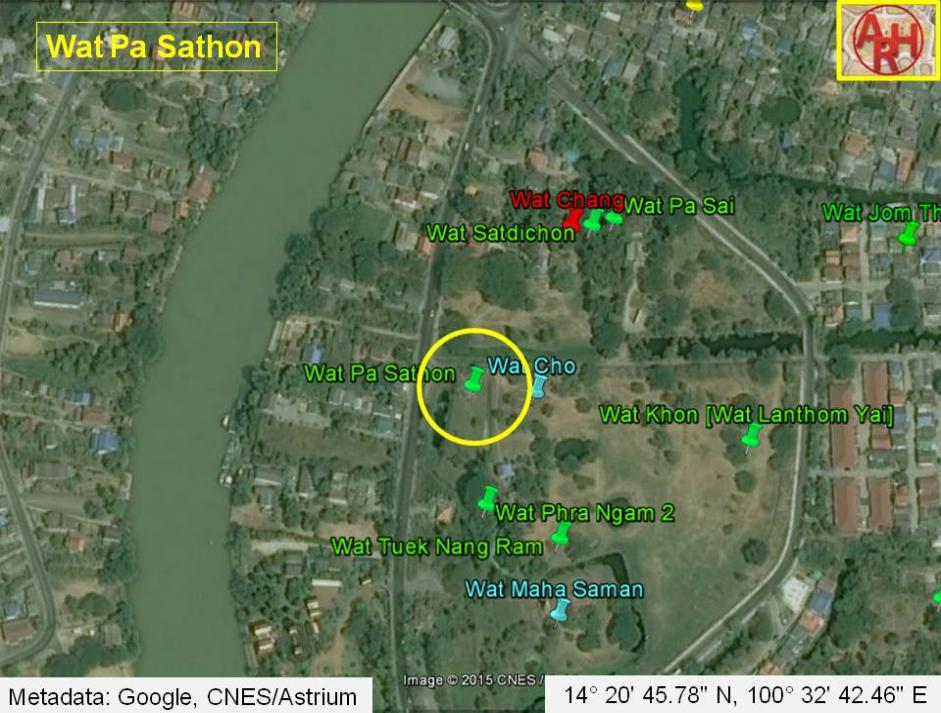
| Wat Pa Sathon or the Monastery of the Santol Quarter (1) was situated on the city island in the southwestern area of Ayutthaya in Pratu Chai Sub-district. The monastery stood on the bank of Khlong Tha Phra also called Khlong Klaep. In its immediate vicinity were Wat Satdichon, Wat Pa Sai and Wat Chang. There are no traces of foundations or brick work at ground level and the temple is classified as disappeared. The site is mentioned on Phraya Boran Rachathanin's map drafted in 1926 on the northern canal bank. A 2007 Fine Arts Department (FAD) map based on conducted excavations shows Wat Pa Sathon on the opposite side of the canal as in contrary what is indicated by Phraya Boran Rachathanin. Historical data about the monastery and its construction is unknown. The site is located in geographical coordinates: 14° 20' 45.78" N, 100° 32' 42.46" E. Footnotes: Sathon (สะท้อน) also called krathon (กระท้อน) = Santol also called sour apple or cotton fruit. Latin name: (Sandoricum koetjape). |

| (Detail of a 2007 Fine Arts Department GIS map - Courtesy of the Fine Arts Department - 3th Region) |

| (Santol - Detail from 'Flora de Filipinas (1877-1883)- Gran edicion - Atlas I - Francisco Manuel Blanco) |