| WAT PHROM KALAYARAM |
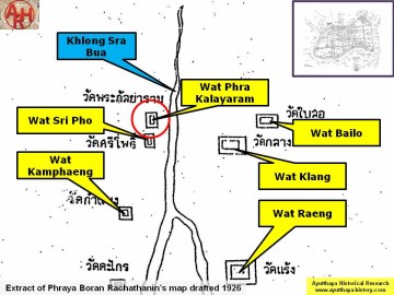
| Wat Phrom Kalayaram, sometimes mentioned as Wat Phra Kalayaram, (Th: Kalaya = older sister) was located off the city island in the northern area in Khlong Sra Bua sub-district. The temple was situated on the west bank of Khlong Sra Bua in an area called Thung Khwan. Wat Sri Pho stood in the south, Wat Phra Ngam in the west and Wat Bailo on the opposite side of the canal. Not much is known of this temple. The temple site was occupied by the Burmese army in the last Burmese-Ayutthaya war of 1766-1767. The story goes that many Burmese soldiers were killed on this site due to a heavy large gun fire from the city. Apparently the ordination hall (Th: ubosot) was not destroyed. The adjacent Wat Sri Pho and Wat Phrom Kalayaram were fused together in 1942. A new ubosot was built on the ruins of the old ubosot of Wat Phra Kalayaram and the whole complex received the name Wat Mai Sri Pho (The word "Mai" meaning "new"). Historical data about the monastery and its construction are unknown. The site is mentioned on Phraya Boran Rachathanin's map drafted in 1926 and was situated in Geo Coord: 14° 22' 16.47" N, 100° 33' 27.55" E. |

| | | | | | | | |
| Text, maps & photographs by Tricky Vandenberg - March 2010 Updated December 2013, March 2015 |
| | | | | | | |
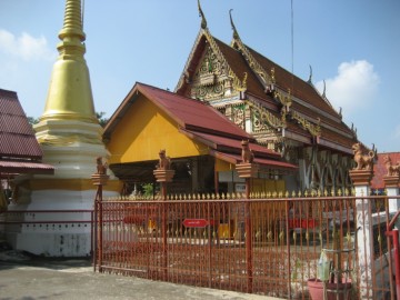
| (New ordination hall of Wat Mai Sri Pho on the ruins of Wat Phrom Kalayaram) |
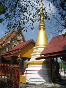
| (Chedi in front of the ordination hall) |
| (Detail of Phraya Boran Rachathanin's map - Anno 1926) |
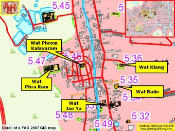

| (Detail of a 2007 Fine Arts Department GIS map - Courtesy of the Fine Arts Department - 3th Region) |