| WAT SAN JAO THONG (วัดศาลเจ้าธง) |
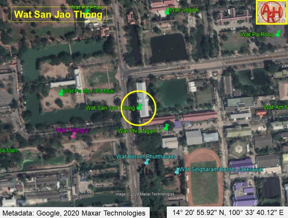
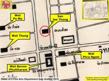
| Wat San Jao Thong or the Monastery of the Shrine of Jao Thong was located on Ayutthaya's city island outside the Historical Park in Pratu Chai Sub-district. There are no traces anymore visible of the monastery above ground level. Historical data about the monastery and its construction are unknown. A mid-19th century map shows Wat San Jao Thong south of an unidentified monastic structure and west of Wat Jingjok, north of a former brick road being an extension of Chinese Street. On the opposite side of the street stood Wat Kot (วัดกด). The monastery bears on this map the name Wat San Jao Thung (วัดสารเจ้าทุง). This location does not match with Phraya Boran Rachathanin's (PBR) map drafted in 1926, which indicates this temple on the west bank of Khlong Chakrai Noi. Wat Pa Nai was on its north; Wat Jingjok stood on its east on the opposite bank of the canal and Wat Phra Ngam was in the south. PBR indicated Wat San Jao Thong as a monastery, but there are indications this could have been a Chinese shrine. Wat Sala Jao Thong must have been approximately located in geographical coordinates: 14° 20' 55.92" N, 100° 33' 40.12" E. |

| | | | | | | | |
| | | | | | | |

| Text & maps by Tricky Vandenberg - March 2010 Updated April 2020 |
| (Detail of Phraya Boran Rachathanin's map - Anno 1926) |
| (Detail of a 19th century map - map is orientated S-N) |
| (Detail of a 1974 Fine Arts Department map - Courtesy Dr. Surat Lertlum, Chulachomklao Royal Military Academy) |