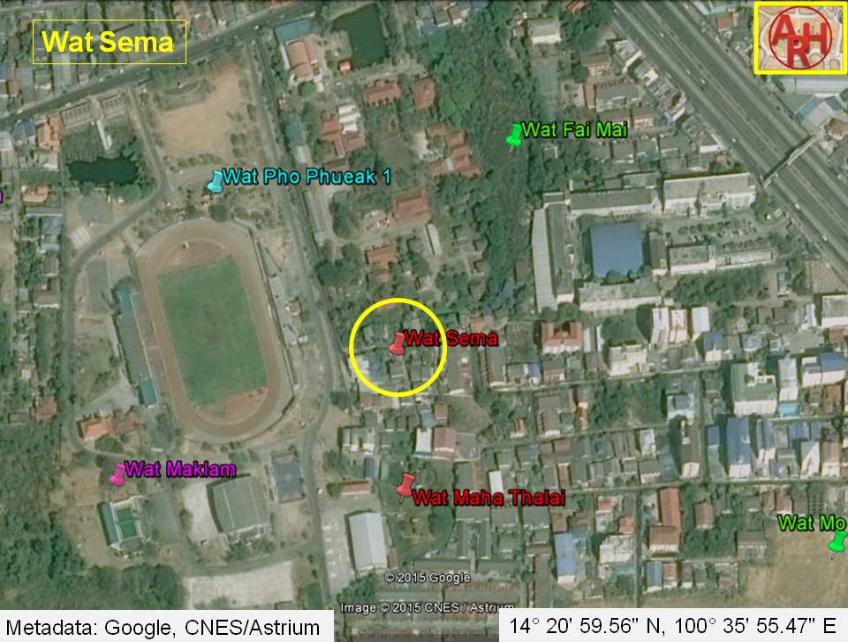
| Wat Sema or the Monastery of the Boundary Stone was located off the city island in the eastern area of Ayutthaya in Phai Ling Sub-district. The temple is located in the vicinity of Wat Yai Chai Mongkhon just outside the boundary of the Ayutthaya Provincial sport complex. Wat Fai Mai lied to its north, while Wat Maha Thalai stood to its south. The last traces of Wat Sema are close to disappear. Only a small part of the wall is remaining, next to a recently set-up small commemoration vihara. Part of the foundation of a chedi is situated a few meters to the east, on private property. The monastery was likely accessible through an ancient canal system, that now has disappeared. Historical data about this monastery and its construction are not known; however, the Fine Arts Department lists other temples in this area as from the Middle Ayutthaya period (1488 - 1629 AD). The monastery is indicated on 1993 and 2007 Fine Arts Department maps. The site is located in geographical coordinates: 14° 20' 59.56" N, 100° 35' 55.47" E. |

| | | | | | | | |
| Text, maps & photographs by Tricky Vandenberg Updated January 2014 |
| | | | | | | |
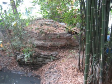
| (Brickwork of Wat Sema in situ) |
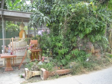
| (Remnants of a chedi) |
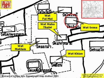
| (Detail of a 1993 Fine Arts Department map - Courtesy Khun Supot Prommanot, Director of the 3th Regional Office of Fine Arts) |
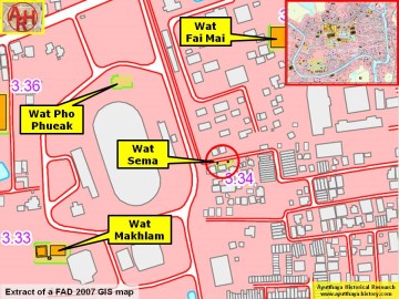
| (Detail of a 2007 Fine Arts Department GIS map - Courtesy of the Fine Arts Department - 3th Region) |
| WAT SEMA (วัดเสมา) |