| WAT SI LIAM 1 (วัดสี่เหลี่ยม) |
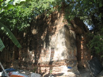
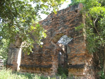
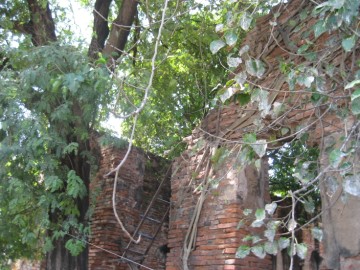
| Wat Si Liam or the Square Monastery is located off the city island in the northern area of Ayutthaya in Lum Phli Sub-district, village 1. The monastery was situated on the west bank of the old Lopburi River, at present Khlong Hua Ro. Wat Pom Raman stands north at the opposite bank of the canal, while Wat Phraya Maen, Wat Dokmai and Wat Bua stood in the south. The brick ruin can be accessed along road # 3060, on the road's east side. 'Si Liam' which means 'four edges' (1), describes the rectangular form of the building. The lower base of the structure is in 'junk-shape', typical for a construction of the Late Ayutthaya period (1629 - 1767). Its historical background and exact period of construction are unknown. The ruin is indicated on 1974, 1993 and 2007 Fine Arts Department (FAD). On the 1993 FAD map the structure received no denomination. The ruin is situated in geographical coordinates: 14° 22' 48.88" N, 100° 33' 21.82" E and was restored in 2012. Another temple bearing the same name is located off the city island in the eastern area in Phai Ling Sub-district. Footnotes: (1) สี่ - four / เหลี่ยม - edge. |

| | | | | | | | |
| Text & photographs by Tricky Vandenberg Updated June 2015 |
| | | | | | | |
| (View of the ruin of Wat Si Liam) |
| (View from the west) |
| (View from the south) |

| (Detail of a 2007 Fine Arts Department GIS map - Courtesy of the Fine Arts Department - 3th Region) |


