
| | | | | | | |
| KHLONG HUA RO |
| Text & photographs by Tricky Vandenberg - August 2010 Reviewed June 2011 |
| | | | | | |
| Khlong Hua Ro is situated off the city island in the northern area in Hua Ro sub-district. Leaving Hua Ro sub-district the canal is the western border of Suan Phrik sub-district as well as the eastern border of the Lum Phli and Khlong Sra Bua sub-districts. Khlong Hua Ro is effectively a stretch of the old Lopburi River. A part of the old Lopburi River running before from Wat Khao Din in Bang Pahan district towards the present Chao Phraya River is actually divided in four stretches, being the Khlong Mueang or city canal from its mouth at Hua Laem until Hua Ro, Khlong Hua Ro from Hua Ro to Wat Pom Raman (north of), Khlong Bang Khuat (short-cut canal) from Wat Klang Raman (south of) and Wat Dao Khanong (Bang Pahan district) and Khlong Pho Sam Ton from Wat Dao Khanong until Wat Muang (Bang Pahan district). As thus we see Khlong Hua Ro running from Hua Ro till its junction with Khlong Bang Khuat, north of Wat Pom Raman. The canal took its name from the old village - Ban Hua Ro - it was flowing along. Ban Hua Ro was situated in Thung Kaeo on the old Lopburi River's west bank (see map). The village on its turn was named after the "Thamnop Ro", a kind of weir made of wooden beams positioned in the water to break the speed of the river in order to prevent damage to the embankments. The water speed breaker was situated at the confluence of the former Lopburi River and the Front city moat in front of the former Maha Chai fortress (were the present Hua Ro market is located). Khlong Hua Ro has following temples on its banks: Wat Sam Vihan near Hua Ro, Wat Chedi Daeng, Wat Phrao (vanished), Wat Tamnak (mound - located a bit more land inwards), Wat Khae (restored ruin), Wat Ngio (vanished), Wat Si Liam (ruin) and Wat Pom Raman. The large lake between the Elephant Kraal and Wat Khae was formed due to excavation of sand for construction. The canal banks were widened and a deep pond created. Near Wat Khae is a wooden bridge connecting the western and eastern canal banks. North of this bridge is a water gate blocking boat traffic further northwards. Khlong Hua Ro ends at a kind of reservoir with three water gates, just south of Wat Klang Raman. One water gate indicates the end of Khlong Hua Ro; the second water gate indicates the beginning of Khlong Bang Khuat, the short-cut canal; and the third water gate leads to the former loop of the old Lopburi River, running along Wat Chang Yai, Wat Chumphon and Wat Tum. Two other canals run into Khlong Hua Ro, being Khlong Daeng and Khlong Sra Bua. Whenever there was an elephant round-up, royal barges used to depart from Wasukri Landing in front of the Grand Palace, turning into Khlong Sra Bua at Wat Na Phra Men, to finally access the old Lopburi River (present Khlong Hua Ro) near Wat Ngio, from where in a short river descent the barges arrived at the elephant kraal. |


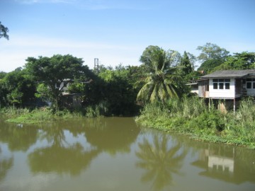
| (View of Khlong Hua Ro) |
| (Bridge over Khlong Hua Ro near Wat Khae) |
| (Mouth of Khlong Sra Bua) |
| (Watergate north of Wat Khae) |

| (Ban Hua Ro on an old military map) |