| WAT THA KHLONG 2 (วัดท่าขลอง) |

| | | | | | | | |
| Text & maps by Tricky Vandenberg - July 2010 Updated August 2011, October 2013, October 2015 |
| | | | | | | |
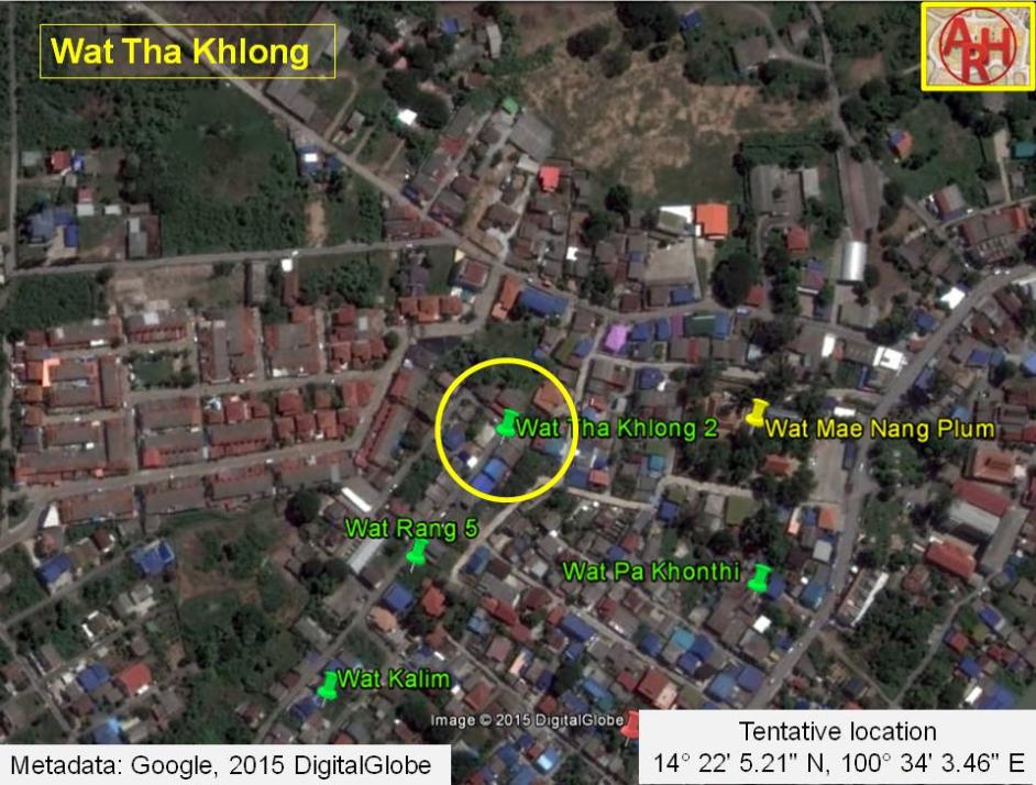
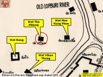
| Wat Tha Khlong or Monastery of the Landing of the Herd of Elephants was located off the city island in the northern area of Ayutthaya in Hua Ro Sub-district. The monastery features on Phraya Boran Rachathanin's 1926 map, and on a 1957 and 1974 Fine Arts Department map. On the latter map the monastery is denominated Wat Tha Phlong (วัดท่าโพลง). The monastery was situated above the north bank of the old Lopburi River, presently called Khlong Mueang or city canal, and west of Wat Mae Nang Plum, located near the village Ban Hua Ro. Following above mentioned maps, Wat Tha Khlong was pinched in between Wat Wihan Thong and Wat Mae Nang Plum. In the 16th century, prior the extension of Ayutthaya's city wall, elephants were kept in an area between Wat Song and Wat Khun Saen. Whether or not Tha Khlong had a relation with this, is unknown. Historical data about the monastery and its construction are unknown. In the manuscript Testimony of the king from Wat Pradu Songtham, a document likely compiled in the Early Ratanakosin period, is written that there was a land market in Iron Village at Tha Khlong (Herd Landing). At the village braziers for forging iron nails and cramps, large and small, were sold. [1][2][3] Some remains of a temple were excavated by the Fine Arts Department (FAD) in geographical coordinates: 14° 22' 2.34" N, 100° 34' 1.15" E and called Wat Rang 8. I presume the site could be the former location of Wat Tha Khlong. References: [1] Geographical description of Ayutthaya: Documents from the palace - Dr Winai Pongsripian - Bangkok (2007). [2] Note on the Testimonies and the Description of Ayutthaya - Chris Baker - Journal of the Siam Society, Vol. 99, 2011 - page 77 (paragraph on KWPS). [3] Markets and Production in the City of Ayutthaya before 1767: Translation and Analysis of Part of the Description of Ayutthaya - Chris Baker - Journal of the Siam Society, Vol. 99, 2011- page 52-4. |
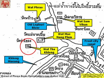
| (Detail of Phraya Boran Rachathanin's map - Anno 1926) |
| (Detail of a 1974 Fine Arts Department map - Courtesy Dr. Surat Lertlum, Chulachomklao Royal Military Academy) |
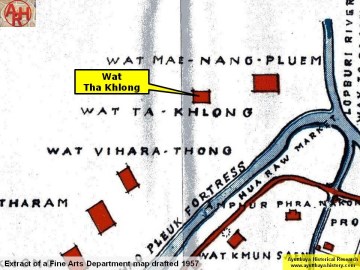
| (Detail of a 1957 Fine Arts Department map) |
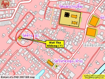
| (Detail of a 2007 Fine Arts Department GIS map - Courtesy of the Fine Arts Department - 3th Region) |