| WAT NOM DUAN (วัดนมด้วน) |

| Text & maps by Tricky Vandenberg - August 2009 Updated January 2015 |
| | | | | | | |
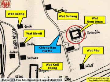
| (Detail of a 1974 Fine Arts Department map - Courtesy Dr. Surat Lertlum, Chulachomklao Royal Military Academy) |
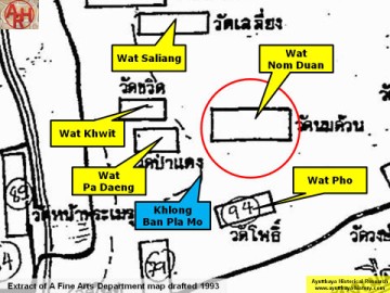
| (Detail of a 1993 Fine Arts Department map - Courtesy Khun Supot Prommanot, Director of the 3th Regional Office of Fine Arts) |
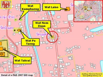
| Courtesy of the Fine Arts Department - 3th Region / Be aware the position of Wat Pa Daeng on this map is wrong) |
| | | | | | | | |
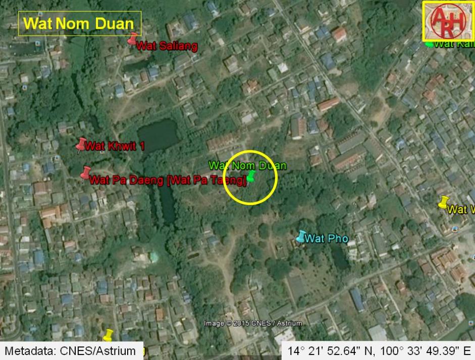
| Wat Nom Duan was located off the city island in the northern area of Ayutthaya in Khlong Sra Bua Sub-district. The name of the temple is a bit weird as it can be translated as the Monastery of the Amputated Breast. The monastery stood in an area called before Thung Kaeo, along the east bank of Khlong Ban Pla Mo; a canal running adjacent to Khlong Sra Bua and which probably ran into the old Lopburi River. The monastery was surrounded by a moat, which westside was the Ban Pla Mo canal. The temple was located south of Wat Saliang, north of Wat Pho and east of Wat Khwit. At present, there are no traces visible of this temple above ground level. The monastery is indicated on the 1974, 1993 and 2007 Fine Arts Department (FAD) maps. Based on the 2007 FAD map, some remains of the temple were excavated by the Fine Arts Department (FAD) in geographical coordinates: 14° 21' 57.64" N, 100° 33' 35.69" E. This area of excavation situated west of Khlong Pha Lai though seems not to match with the position of Wat Nom Duan indicated on the 1974 and 1993 FAD maps, which put the temple east of the canal. Following the two latter maps, the monastery should have been situated in the approximate geographical coordinates: 14° 21' 52.64" N, 100° 33' 49.39" E. |