| WAT PHRA NGAM 2 (วัดพระงาม) |

| | | | | | | | |
| Updated April 2011, April 2013, March 2015 |
| | | | | | | |
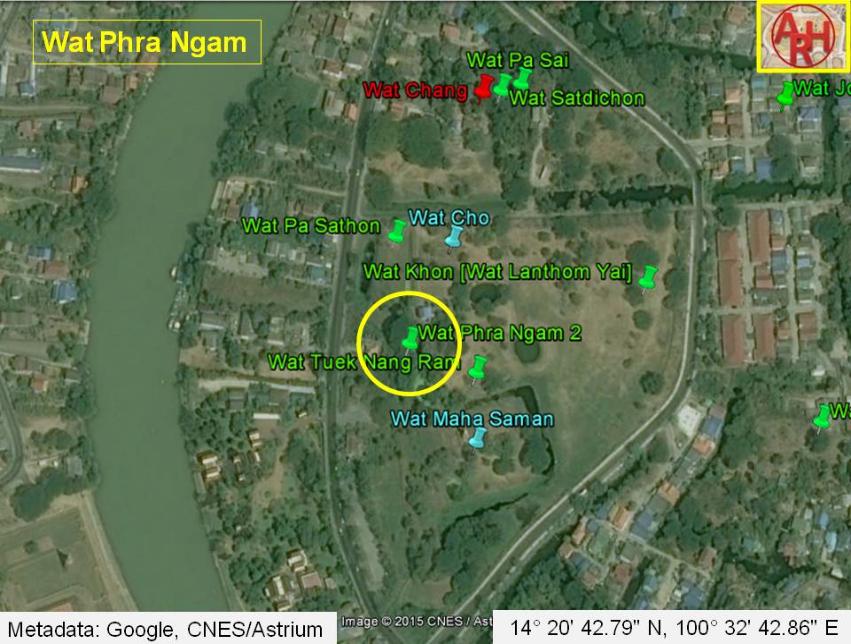
| Wat Phra Ngam or the Monastery of the Beautiful Buddha was situated on Ayutthaya's city island in the southwestern area in Pratu Chai sub-district, northwest of the Somdet Phra Sri Nakharin Park. The site is part of the Ayutthaya Historical Park. The monastery stood close to the south bank of Khlong Tha Phra (also called as Khlong Klaep). In its immediate vicinity on its west side, stood Wat Cho (restored foundations). Wat Maha Saman was situated south. There are no traces of foundations or brick work at ground level and the temple is classified as disappeared. The site is mentioned on a mid-19th century map in the same position as on Phraya Boran Rachathanin's map drafted in 1926. Historical data about the monastery and its construction is unknown. A 2007 Fine Arts Department map based on excavations, shows Wat Phra Ngam much more south of Wat Cho and indicates Wat Pa Sathon in the position where the older maps have Wat Phra Ngam. The site is situated in Geo Coord: 14° 20' 42.79" N, 100° 32' 42.86" E. |


| (Detail of a 19th century map - map is orientated S-N) |
| (Detail of Phraya Boran Rachathanin's map - Anno 1926) |
| (Detail of a 2007 Fine Arts Department GIS map - Courtesy of the Fine Arts Department - 3th Region) |